-
Metro
These are our main lines, they are the fundamental axis of the dynamics of urban transport in Valle de Aburrá.
Niquía - La Estrella
See line >
San Antonio - San Javier
See line >
-
Metro Cable
These are our main lines, they are the fundamental axis of the dynamics of urban transport in Valle de Aburrá.
San Javier - La Aurora
See line >
Acevedo - Santo Domingo
See line >
Santo Domingo - Arví
See line >
Oriente - Villa Sierra
See line >
Acevedo - El Progreso
See line >
Miraflores - Trece de Noviembre
See line >
-
Tram
The perfect complement to our B line allows the city to connect from east to west in a simple way, besides, it has transformed its entire route into an attractive tourist and gastronomic corridor that you cannot miss.
We will soon incorporate Metro de la 80 to our system.
We will soon incorporate Metro de la 80 to our system.
San Antonio - Oriente
See line >
-
Buses
You may think they're just vehicles like the others, but Metro Culture also advances on 4 wheels, these lines simplify and interconnect the city and the rest of the lines.
U. de M. - Parque Aranjuez
See line >
U. de M. - Parque Aranjuez
See line >
Caribe - La Palma
See line >
Get to know your city with our Integrated Transport System
Don't let the lack of plans affect you, enjoy your city, its culture, art and gastronomy. If you have nothing planned, we offer you options. Discover the stories that inspire us in the city of eternal spring and Valle de Aburrá.
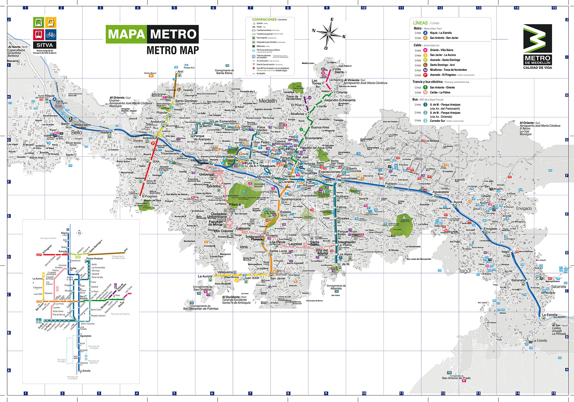
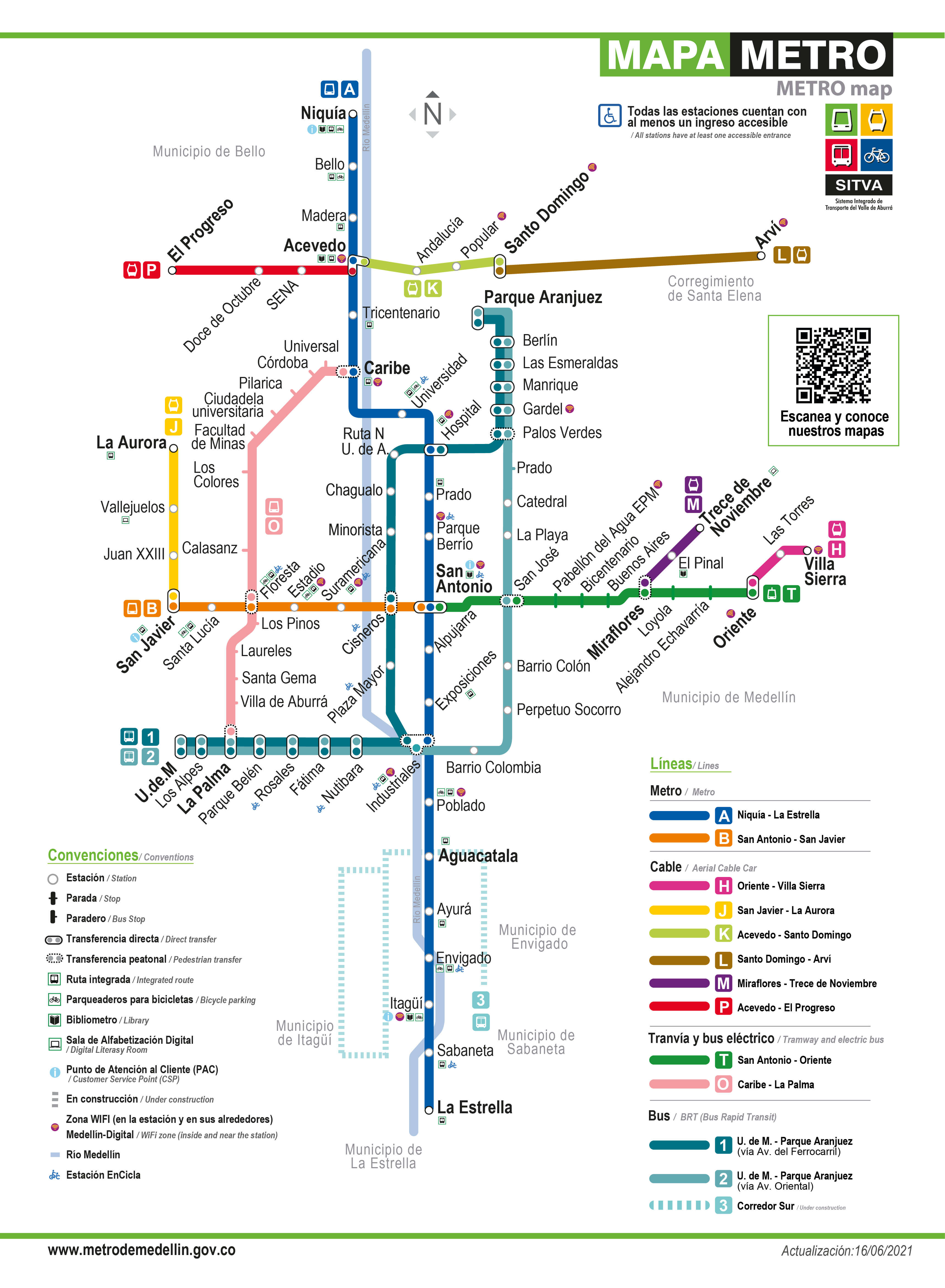
Medellin Metro System Maps
Here you can find all the maps of our Integrated Transport Metro System.
City map
Schematic map
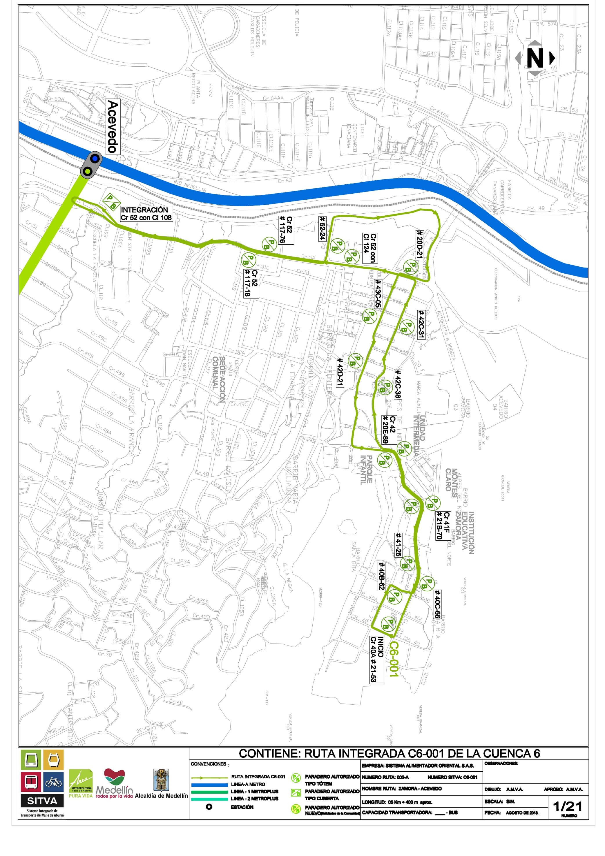
Cuenca 6, route maps
C6-001 Santa Rita - Acevedo Station
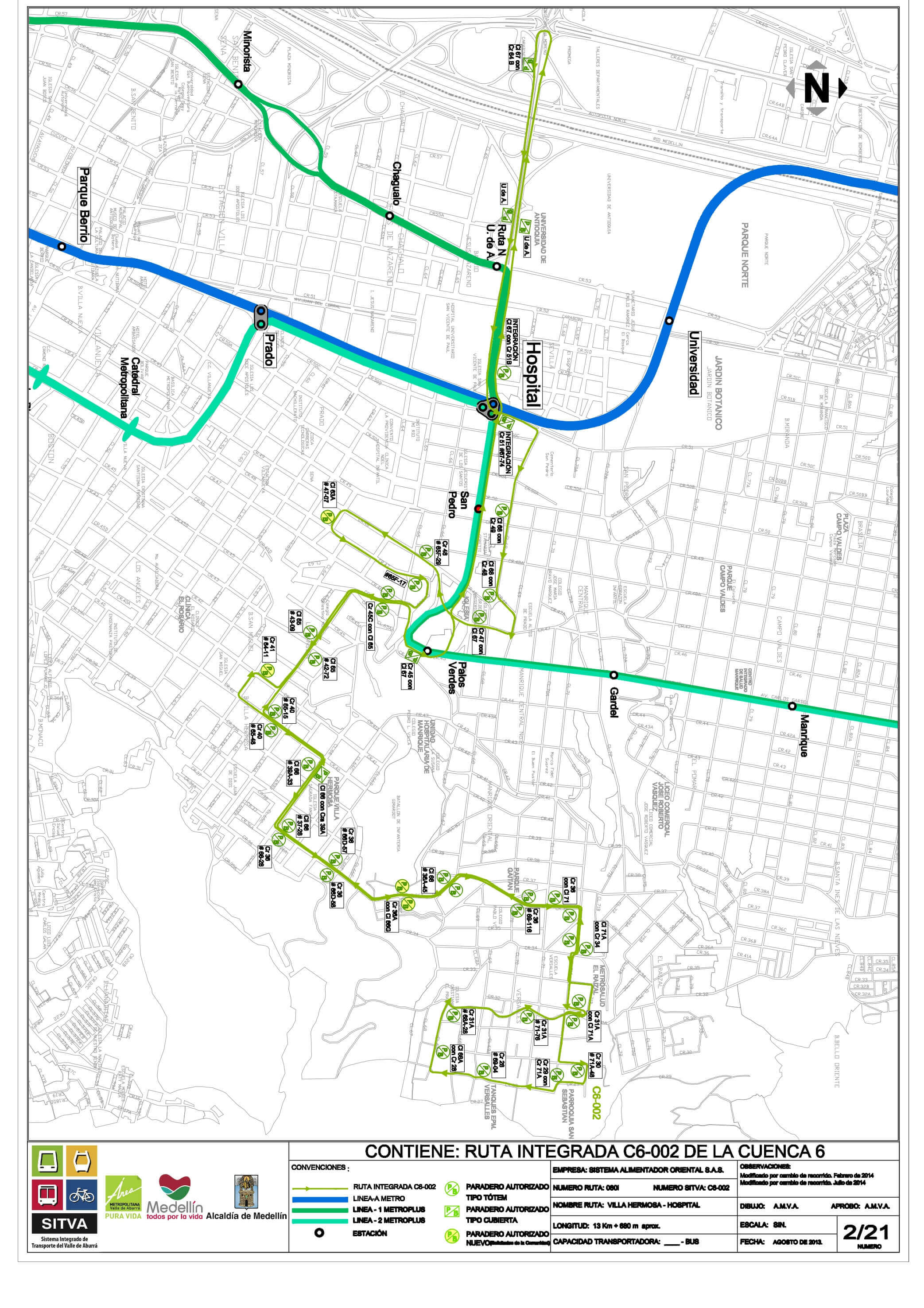
C6-002 Versalles - Hospital Station
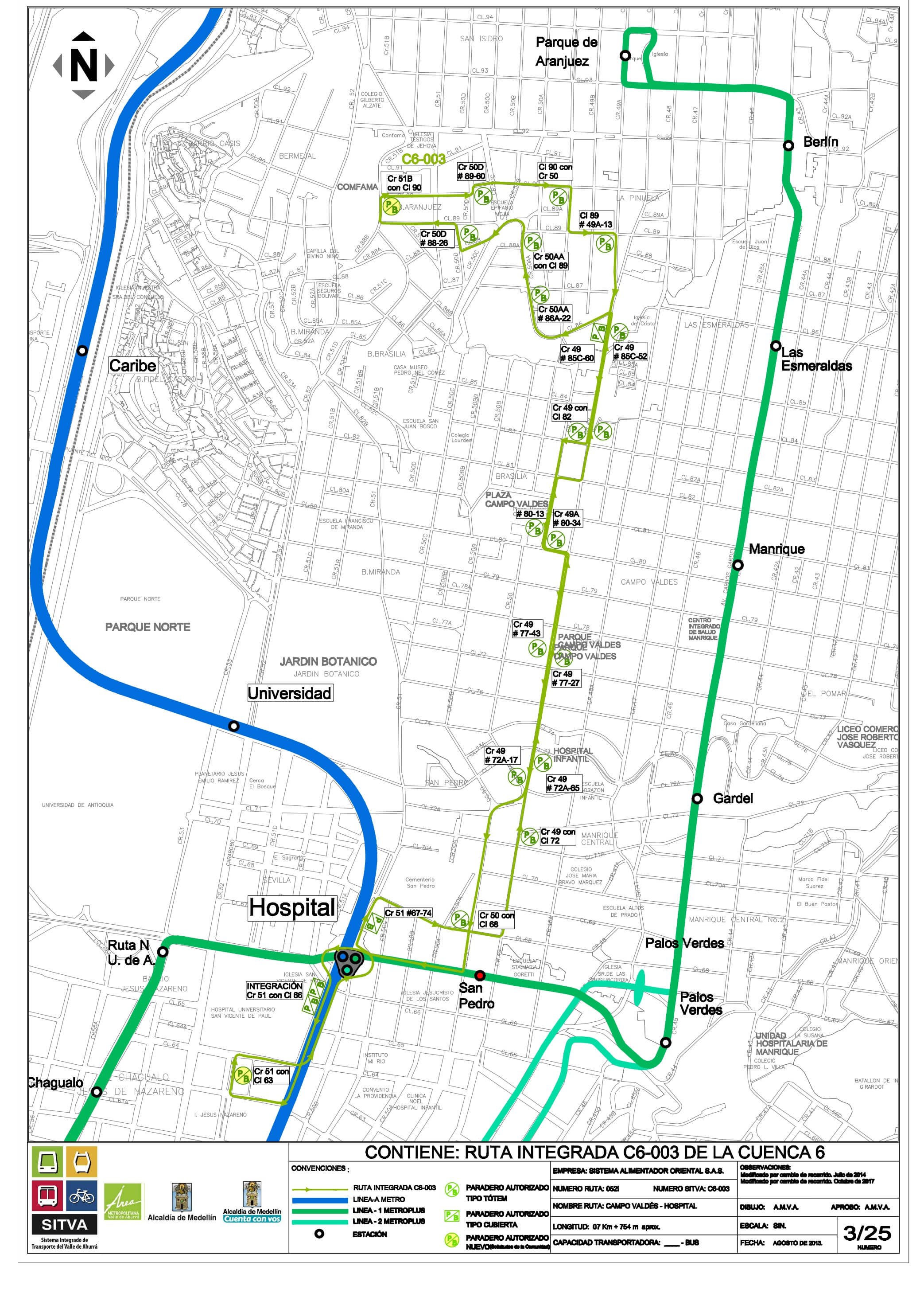
C6-003 Campo Valdés - Hospital Station
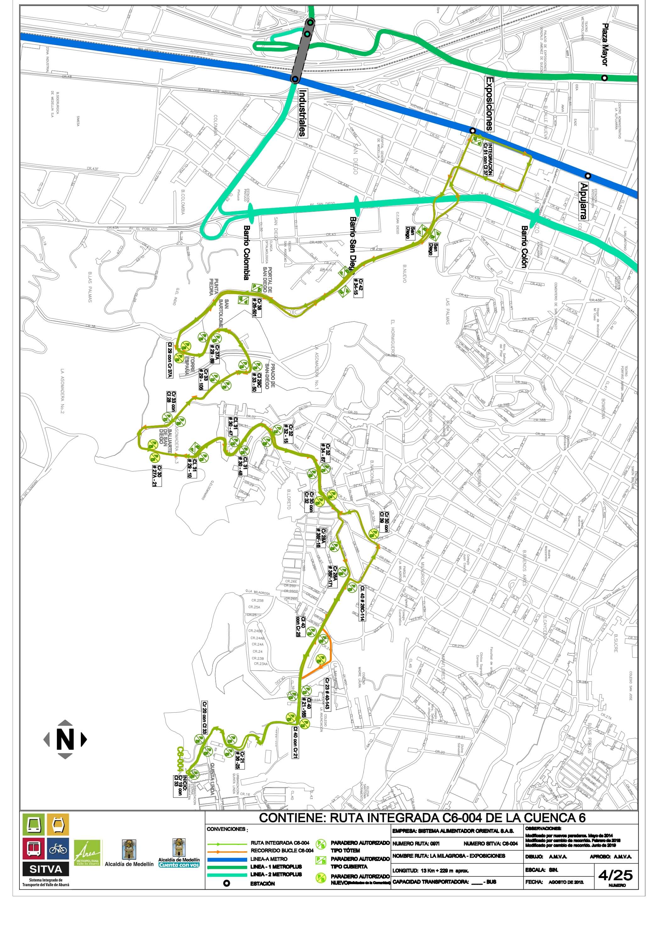
C6-004 Reserva del Seminario - Exposiciones
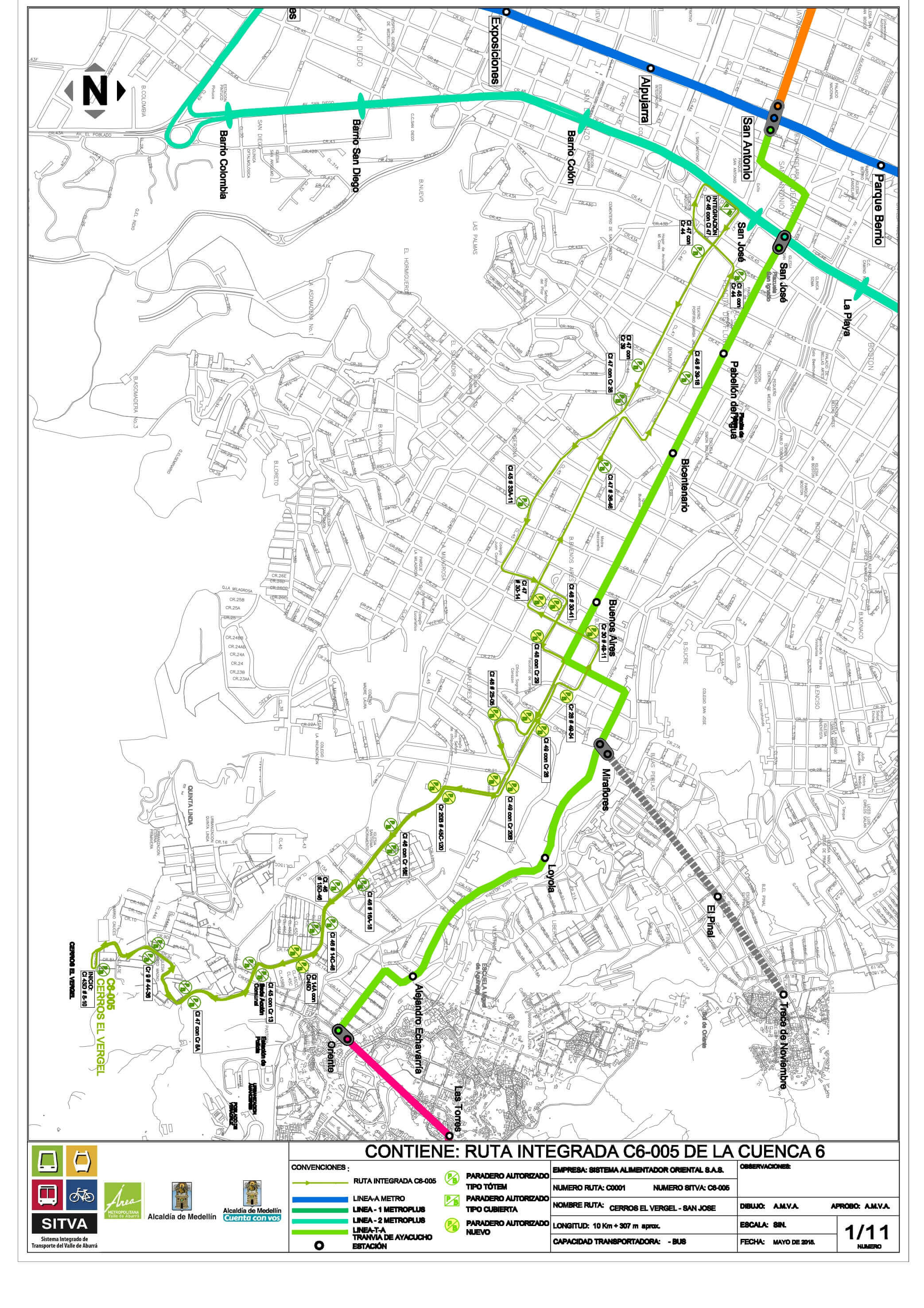
C6-005 Vergel - Parque San Antonio
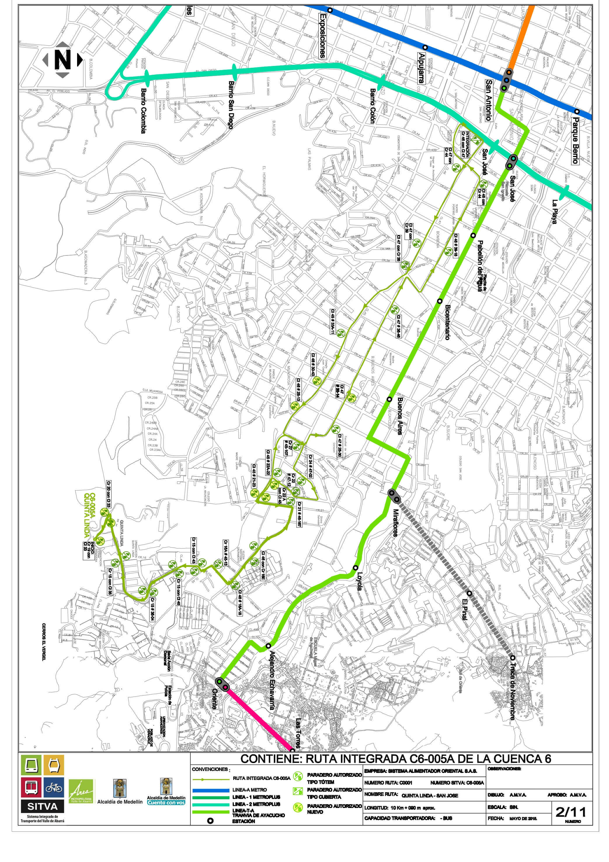
C6-005A Quinta Linda - Parque San Antonio
C6-006 Villa Liliam - Alejandro Echavarría
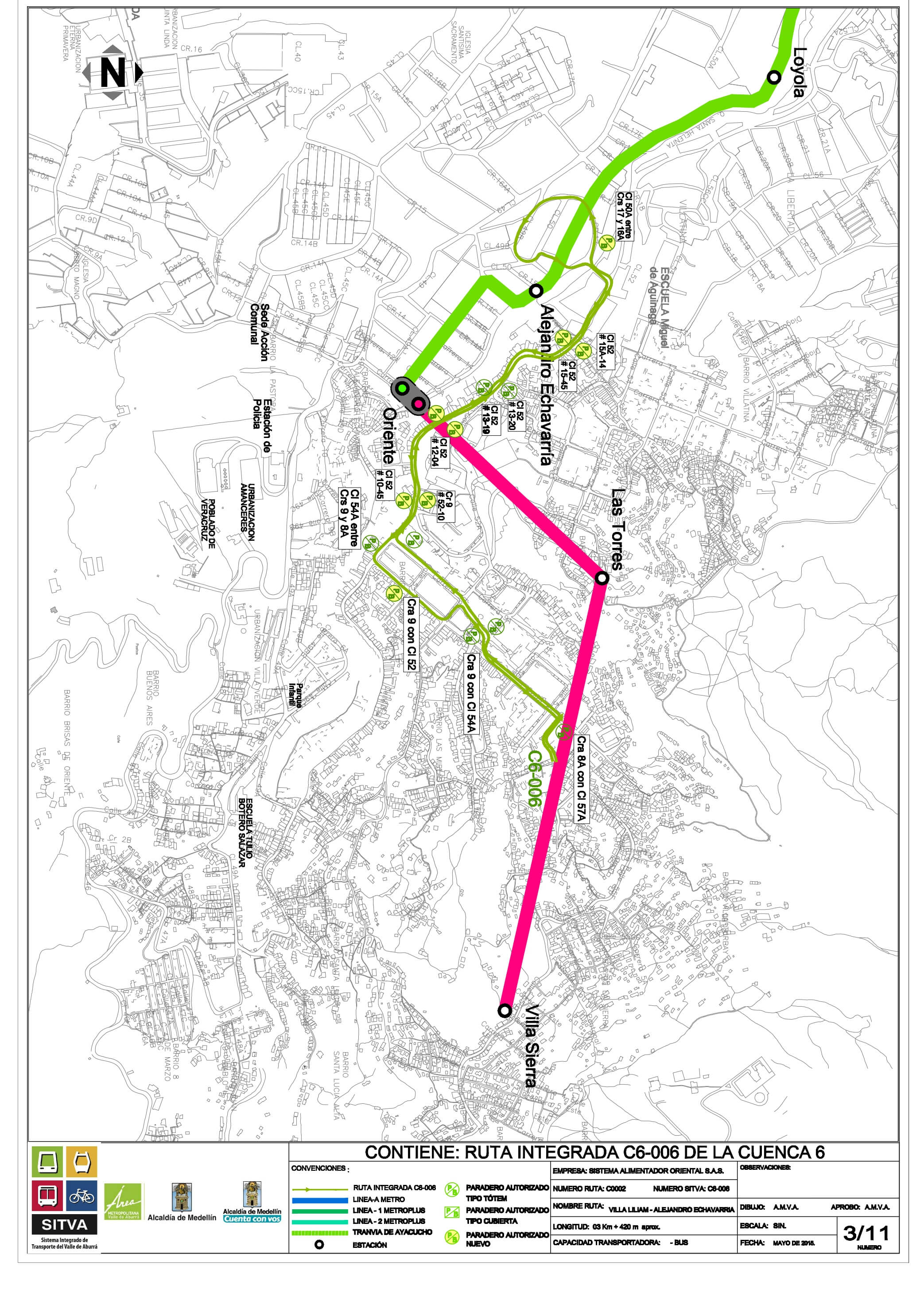
C6-007 Cataluña - San Antonio
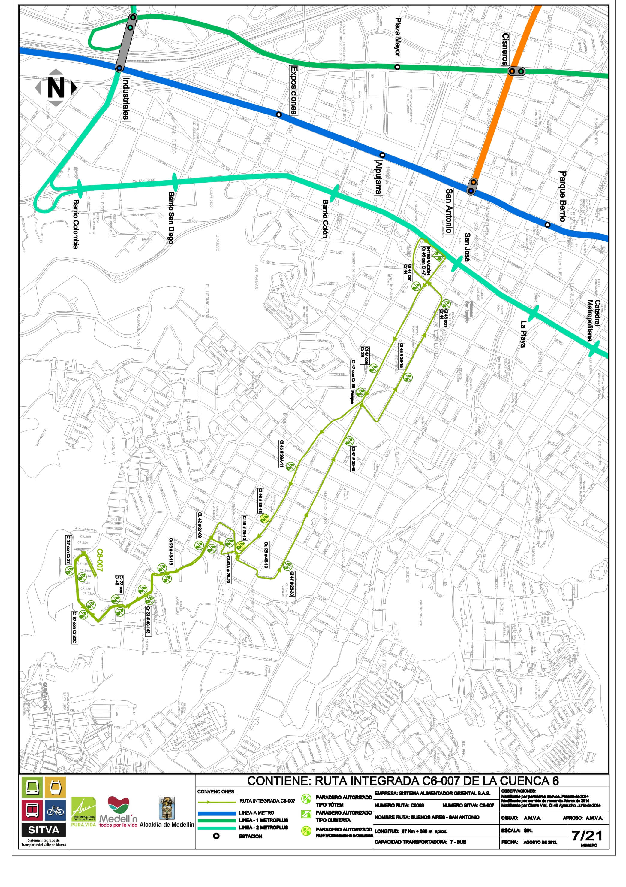
C6-008 La Libertad - Prado Station
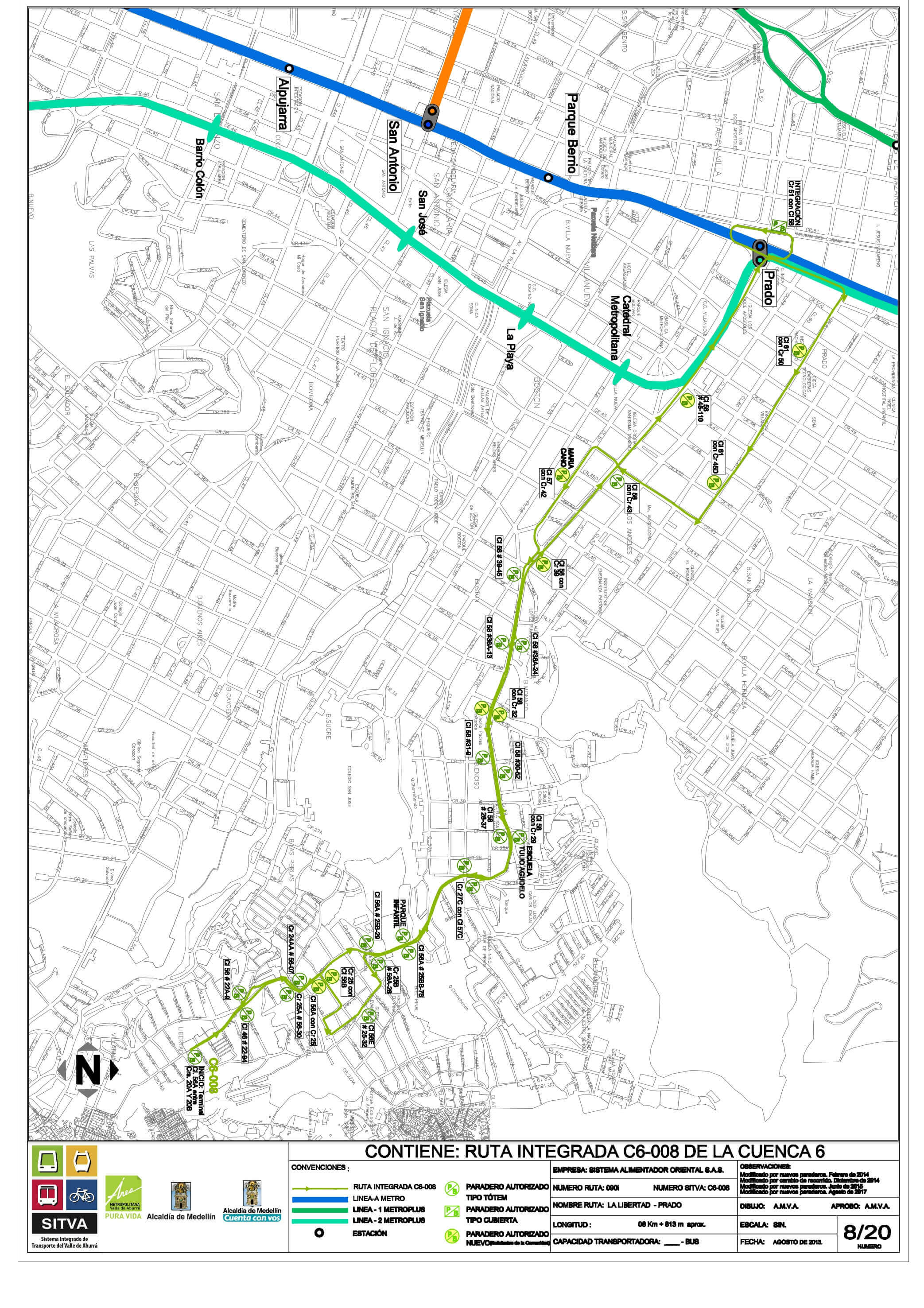
C6-009 Enciso - Prado Station
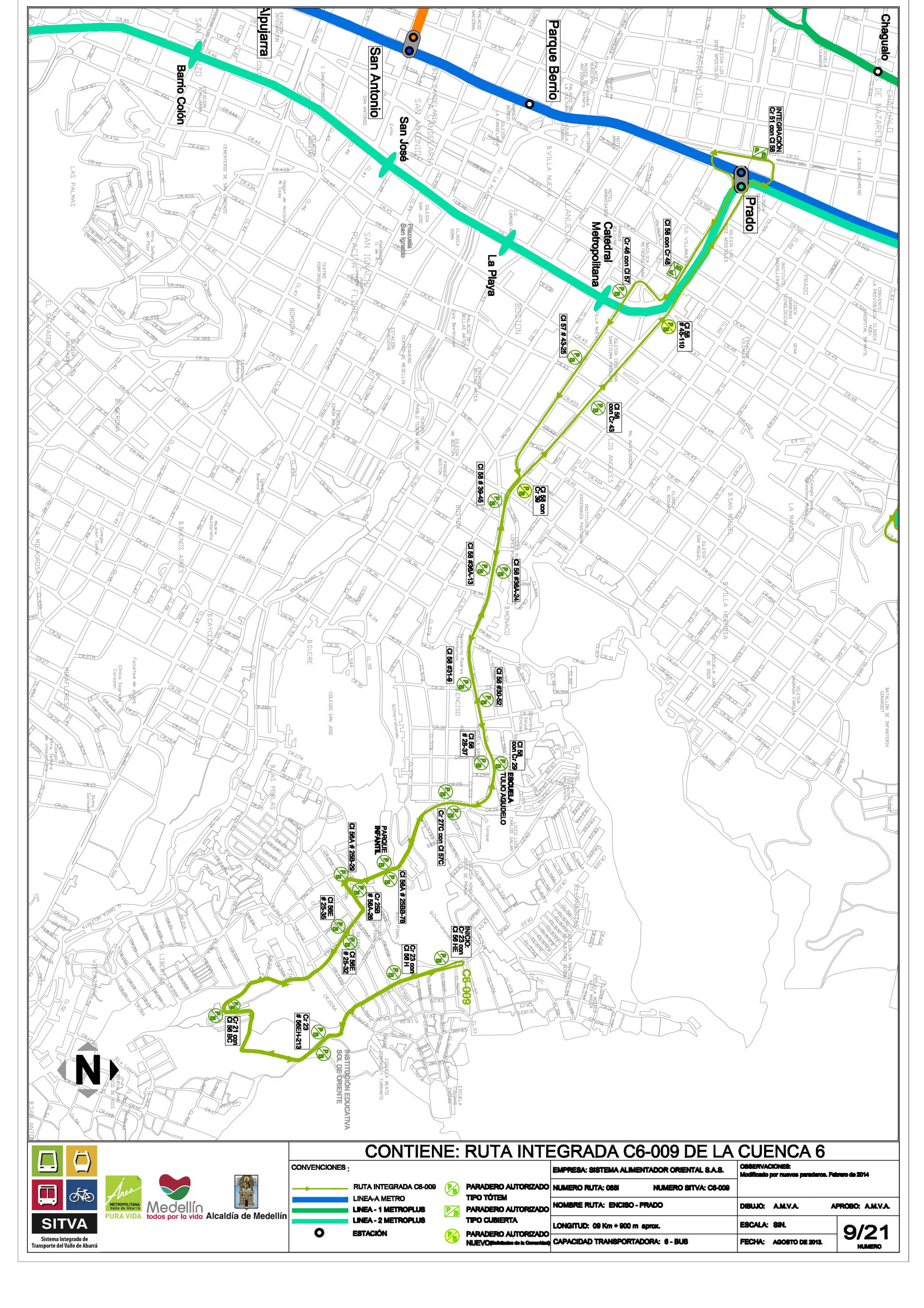
C6-010B Villatina - Parque Berrío Station
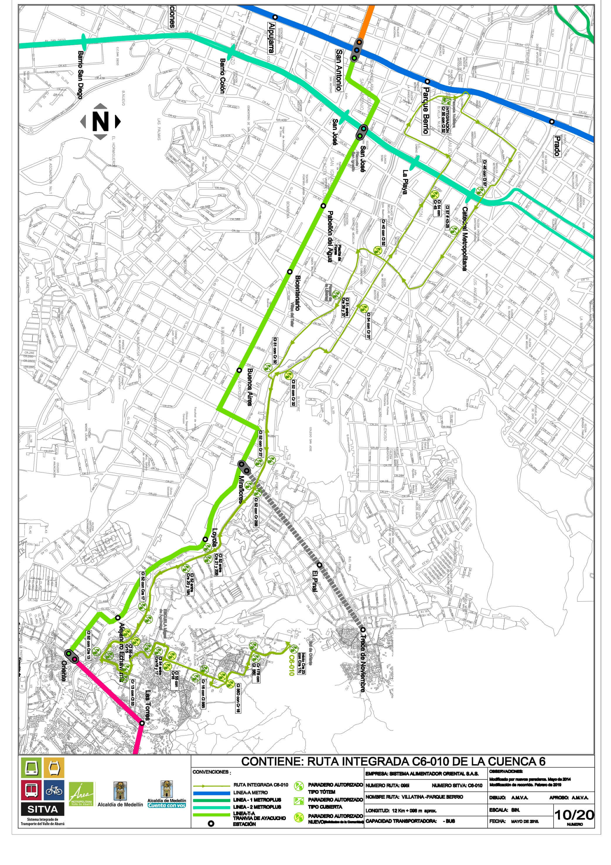
C6-010A Villatina - Alejandro Echavarría
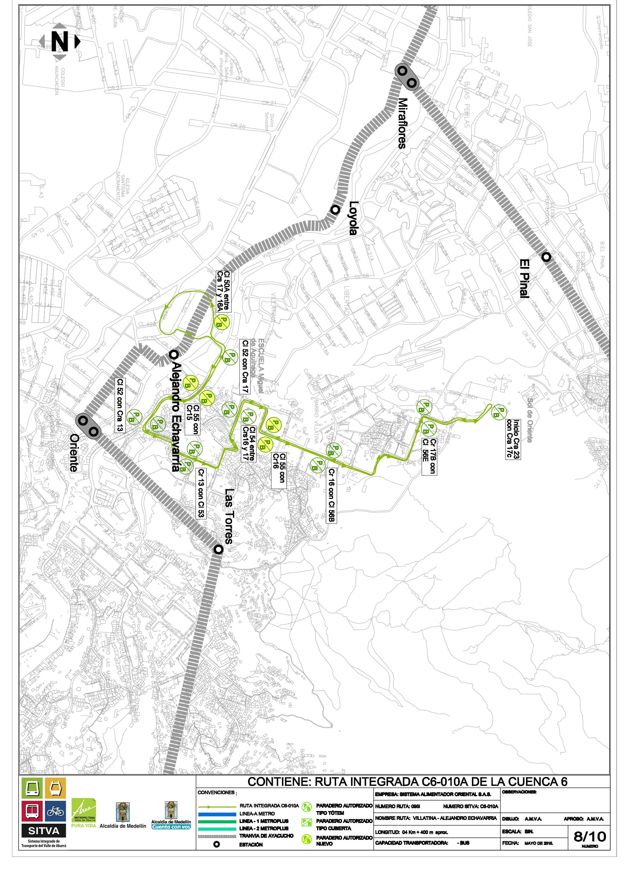
C6-011 Popular Nro.2 - Aranjuez
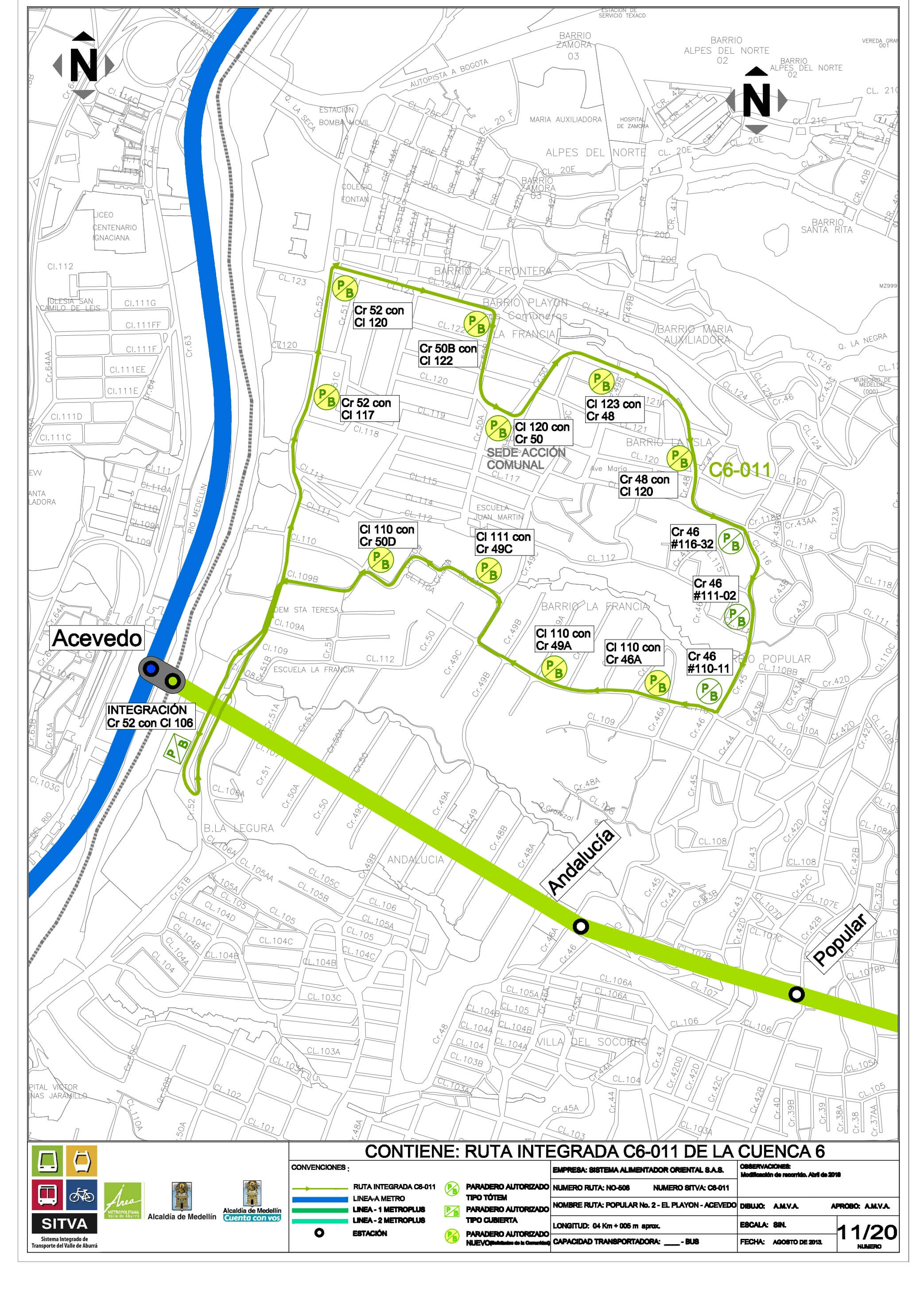
C6-012 La Francia - L1 Aranjuez Station
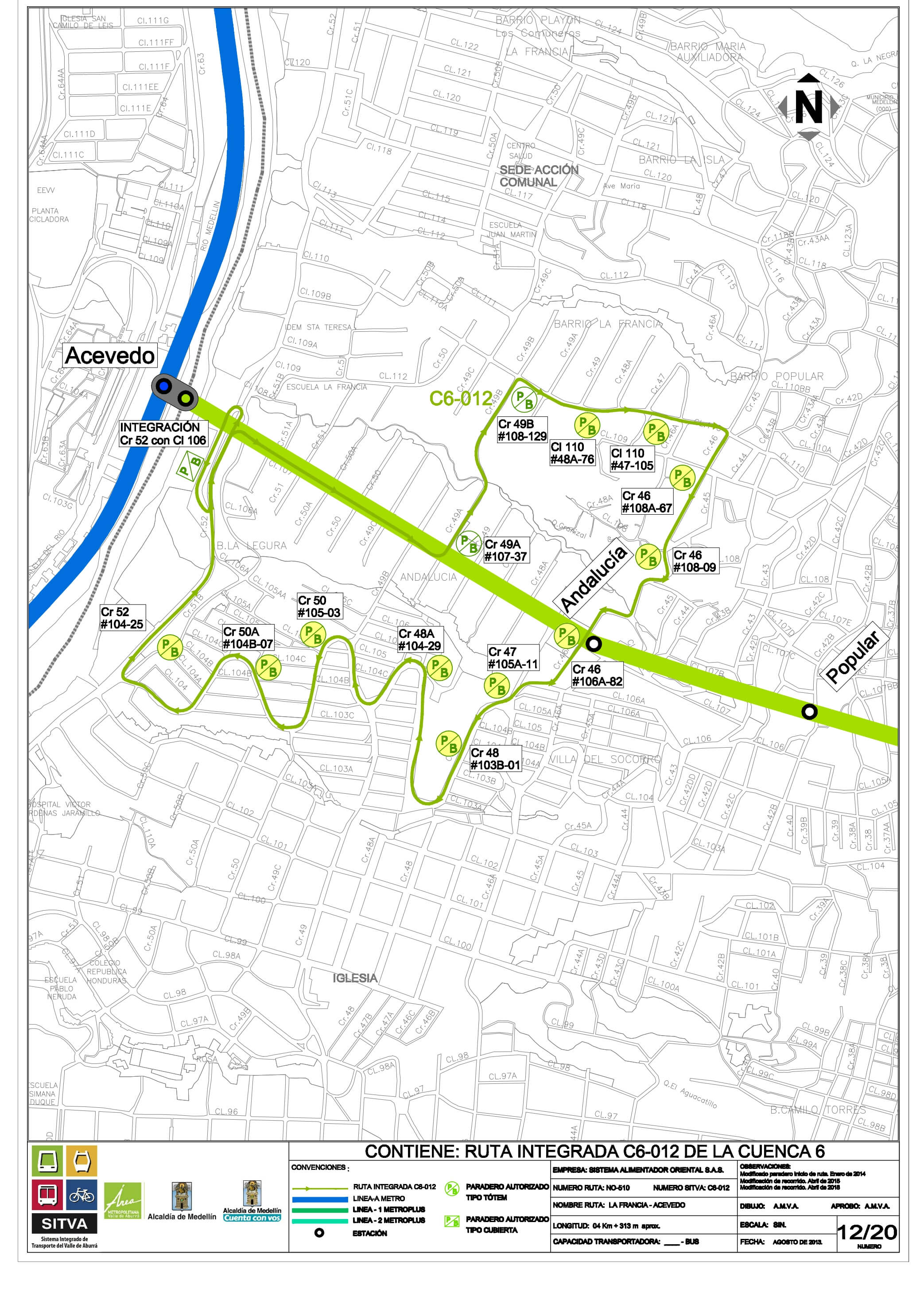
C6-013 Aranjuez Anillo - Tricentenario Station
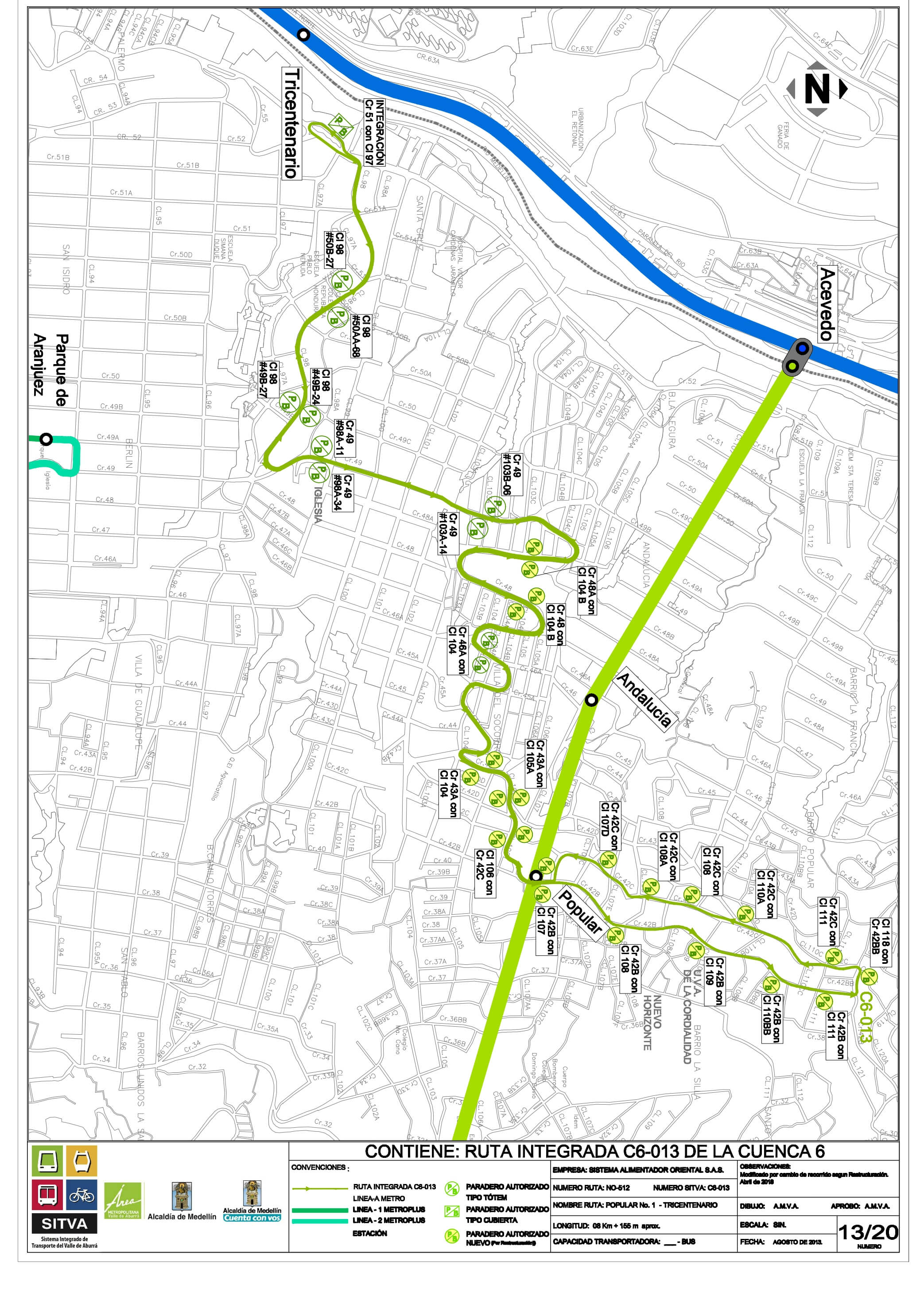
C6-014 La Ladera - Prado
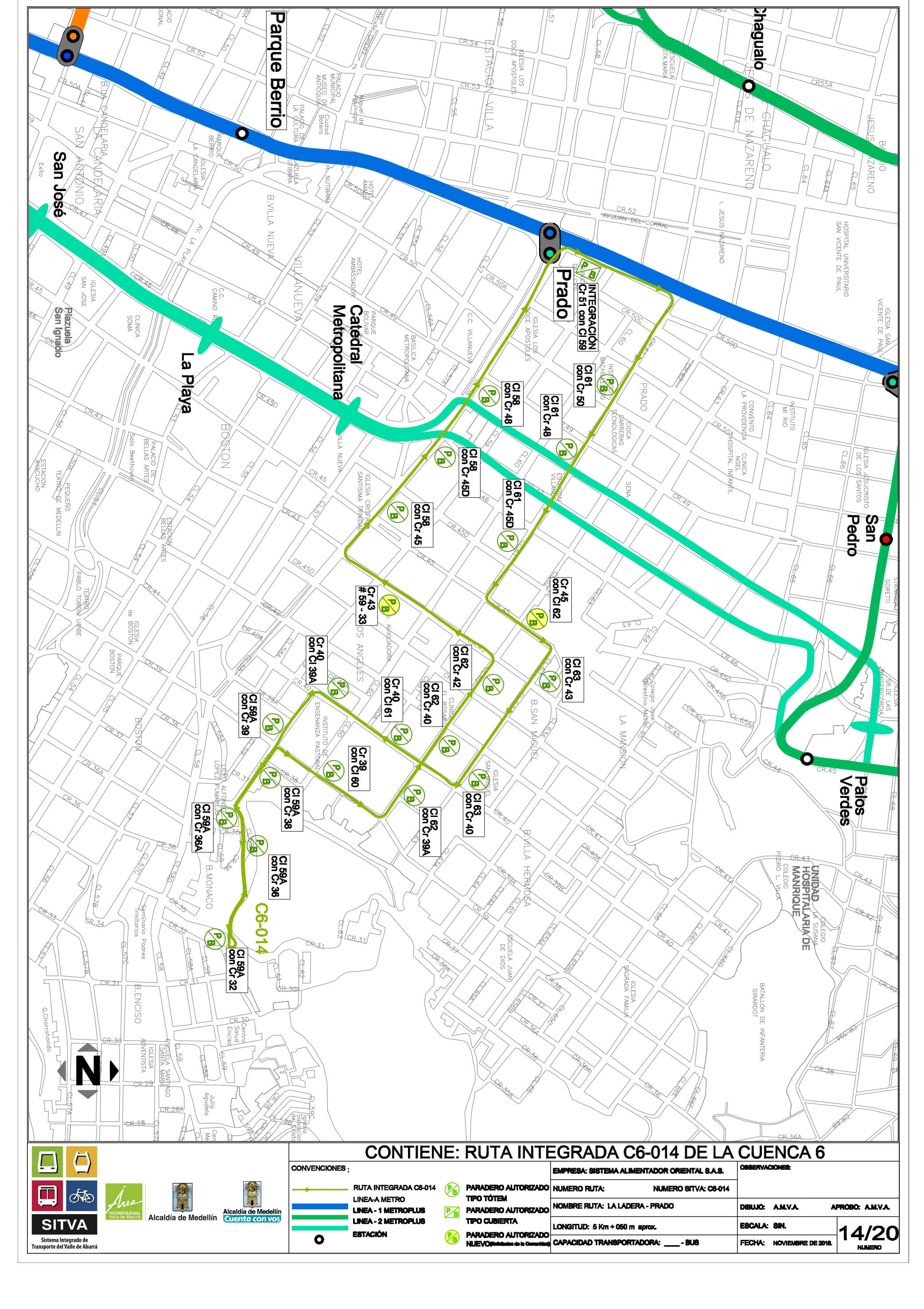
C6-015 Granizal - Hospital Station
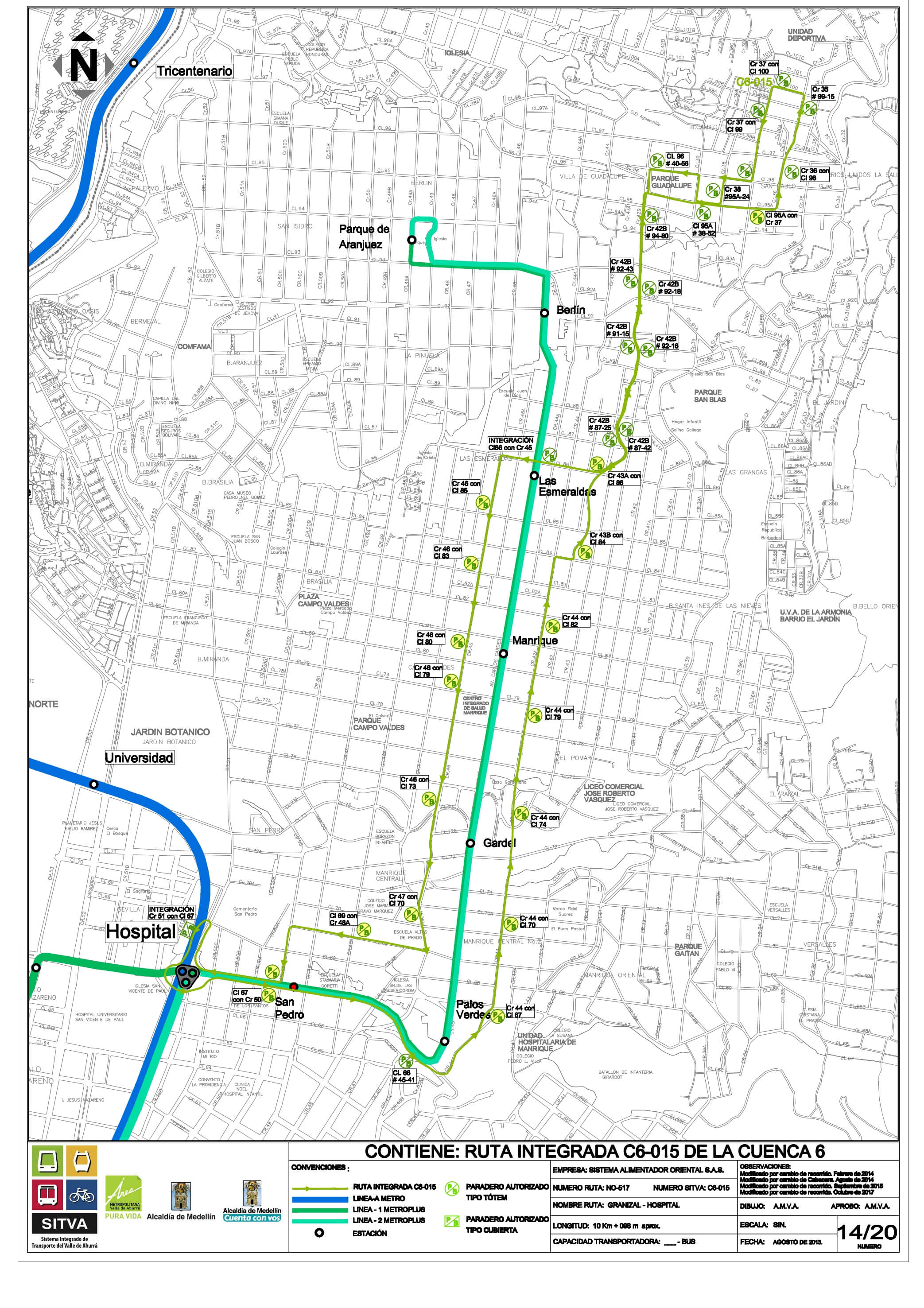
C6-016 Nuevo Horizonte - Hospital Station
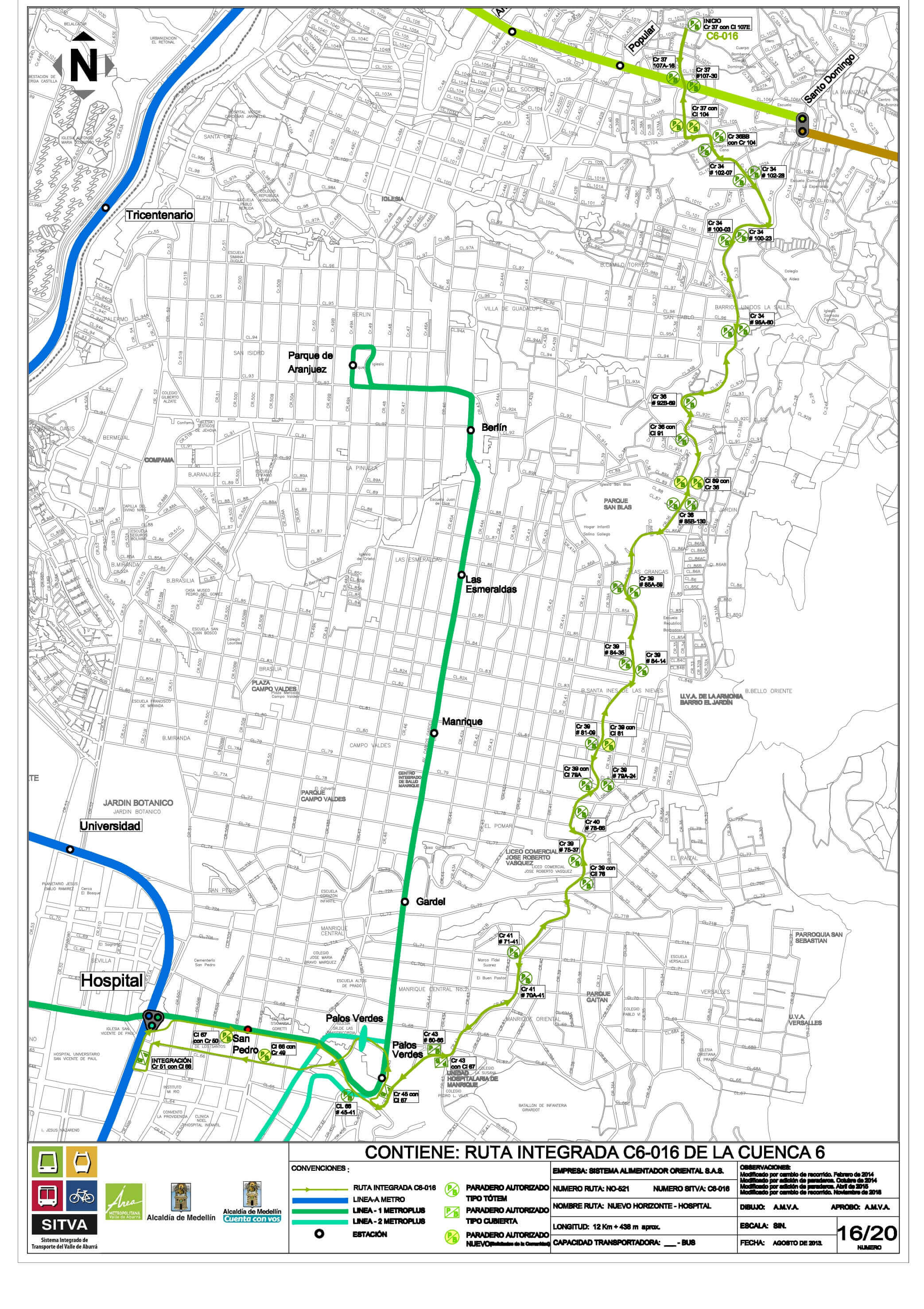
C6-018 Santa Cecilia # 2 - Tricentenario
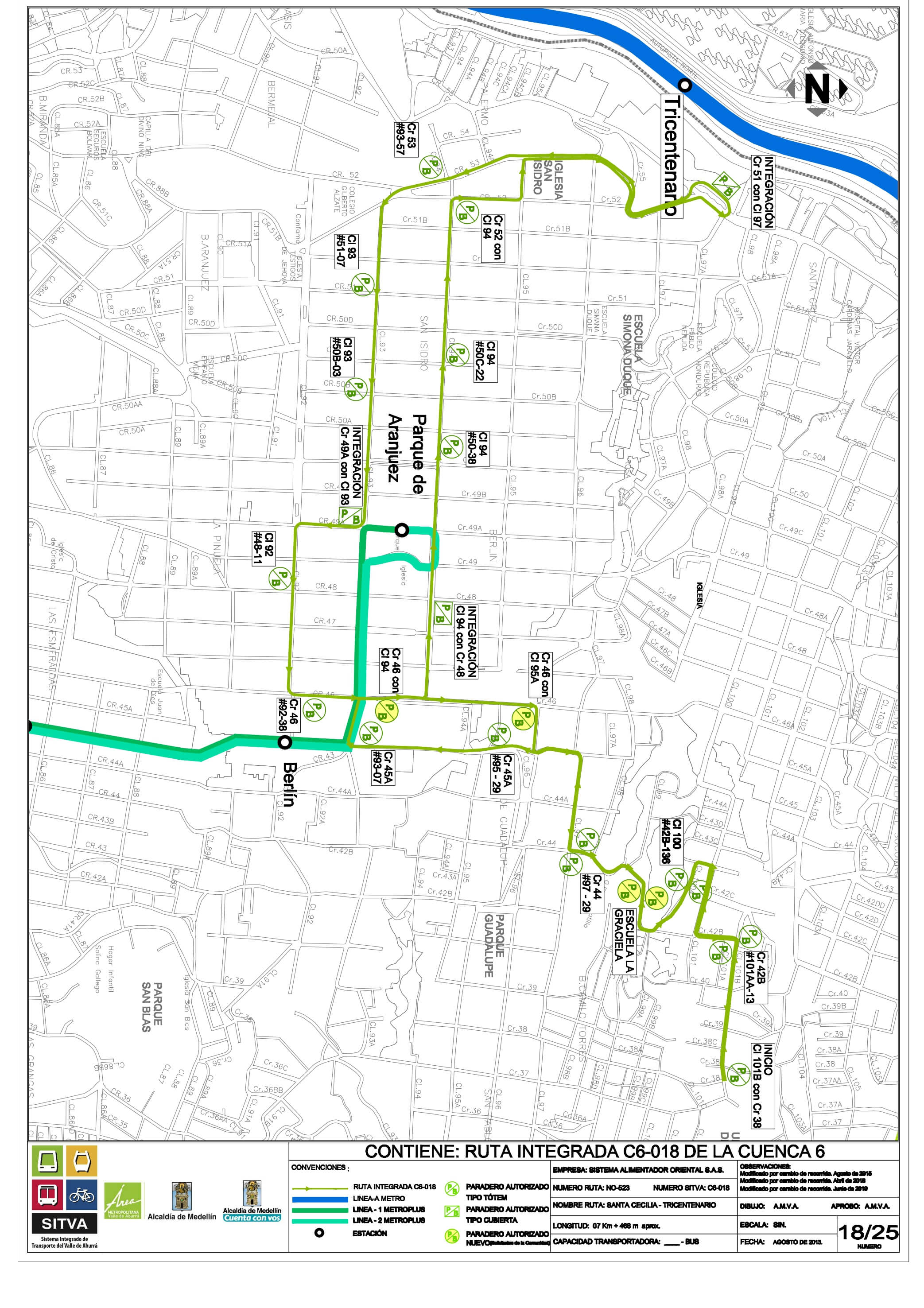
C6-019 El Raizal - Gardel
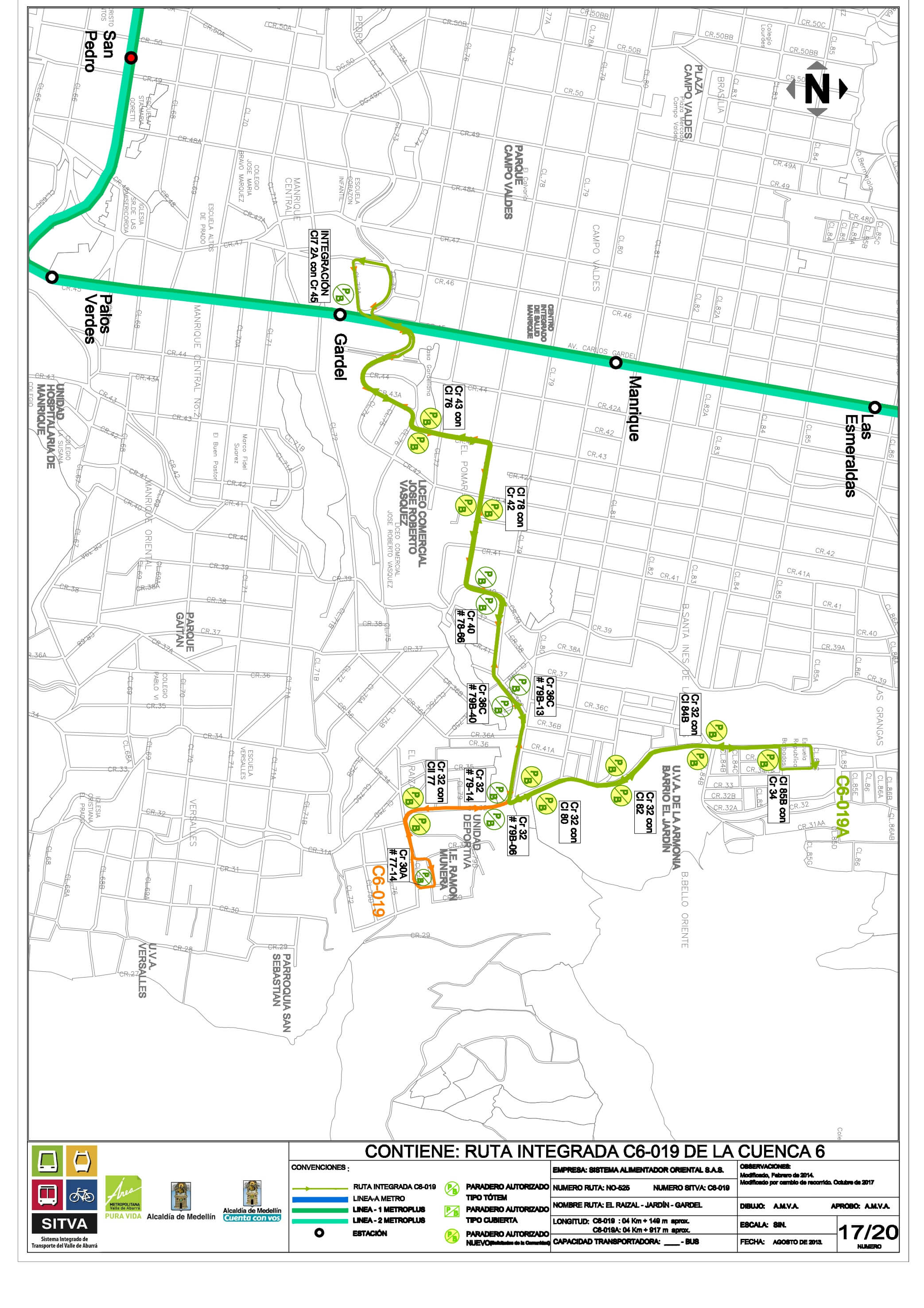
C6-019A Jardín – Gardell
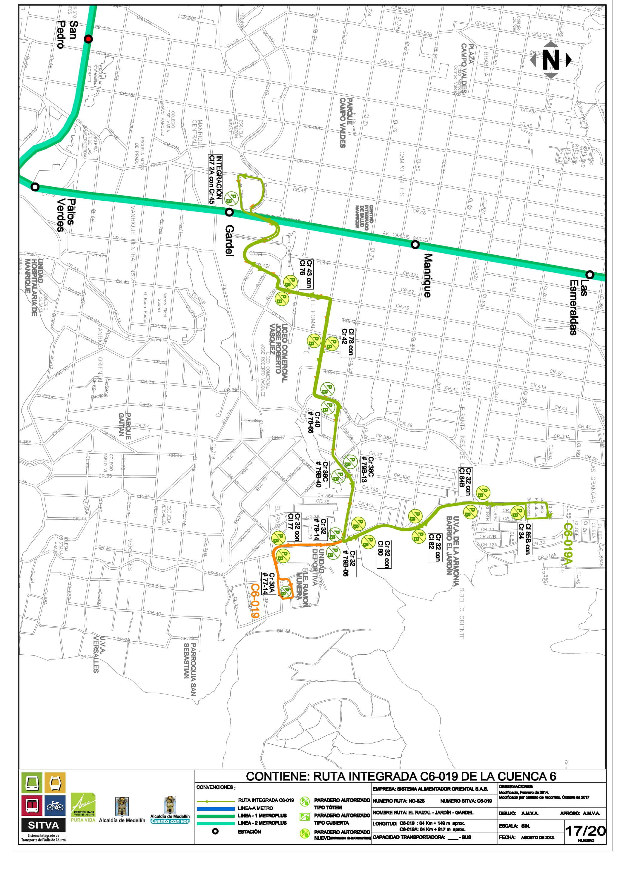
C6-020 San José La Cima - Universidad Station
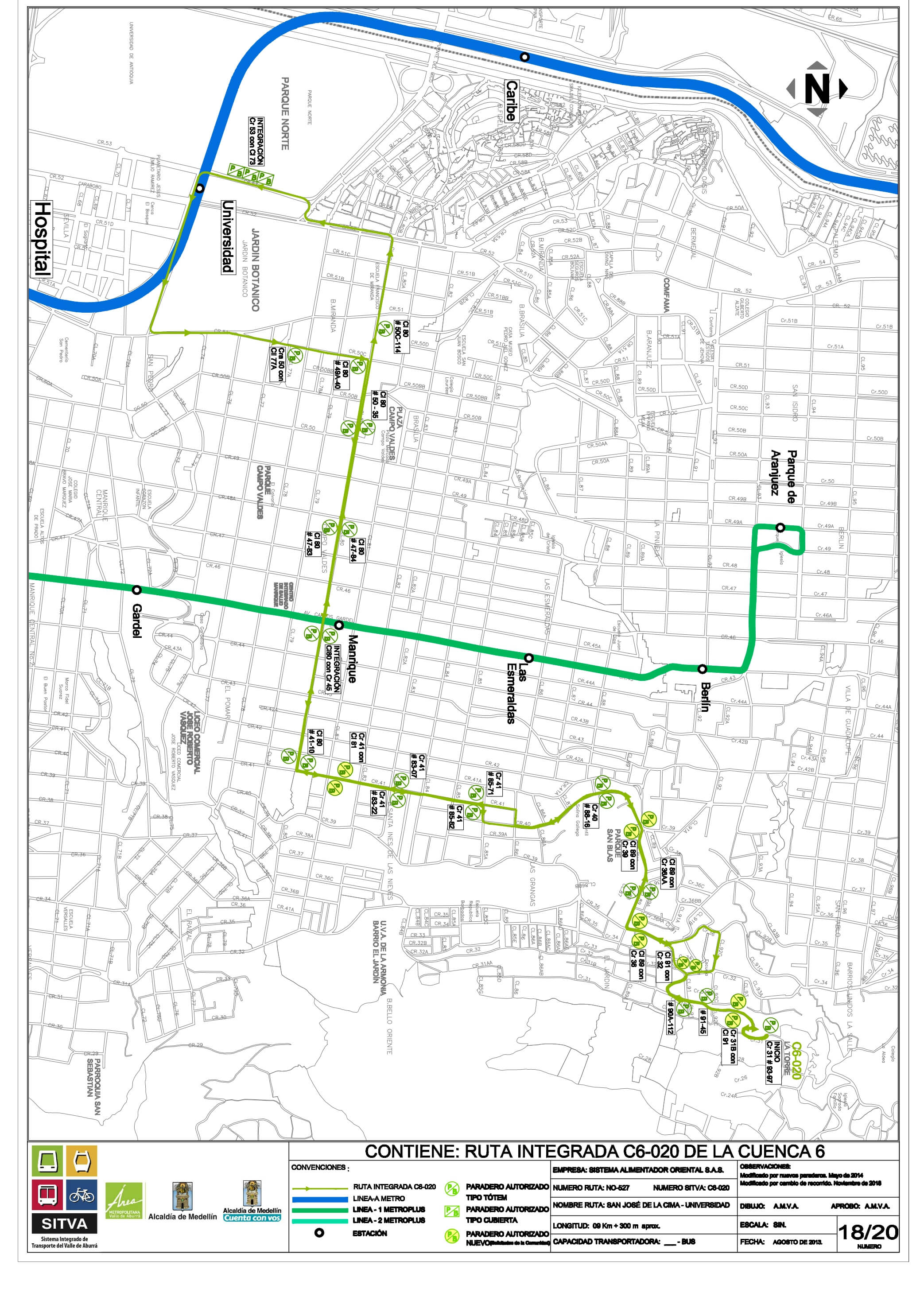
C6-021 Granizal - Aranjuez
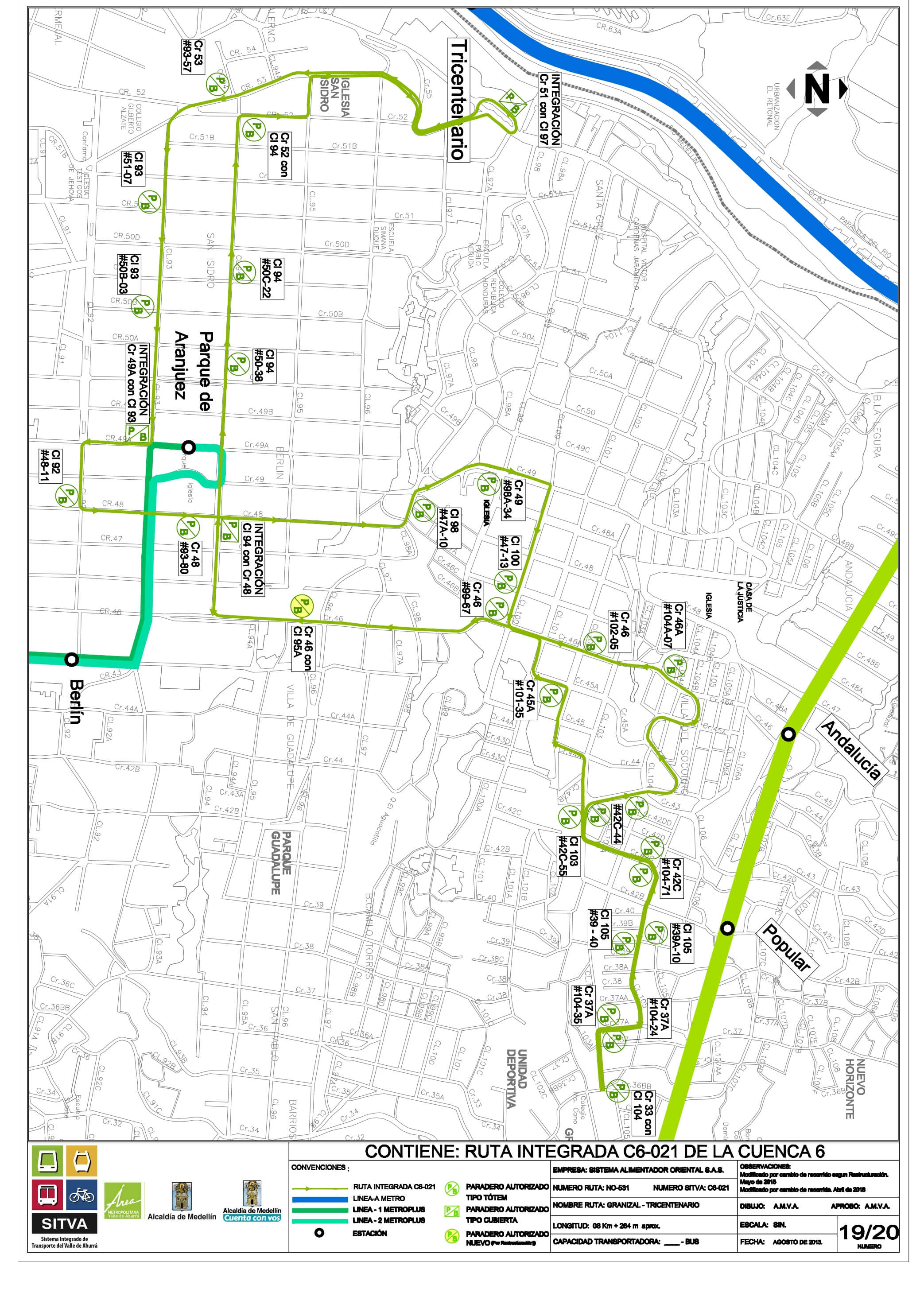
C6-022 La Cruz - Prado Station
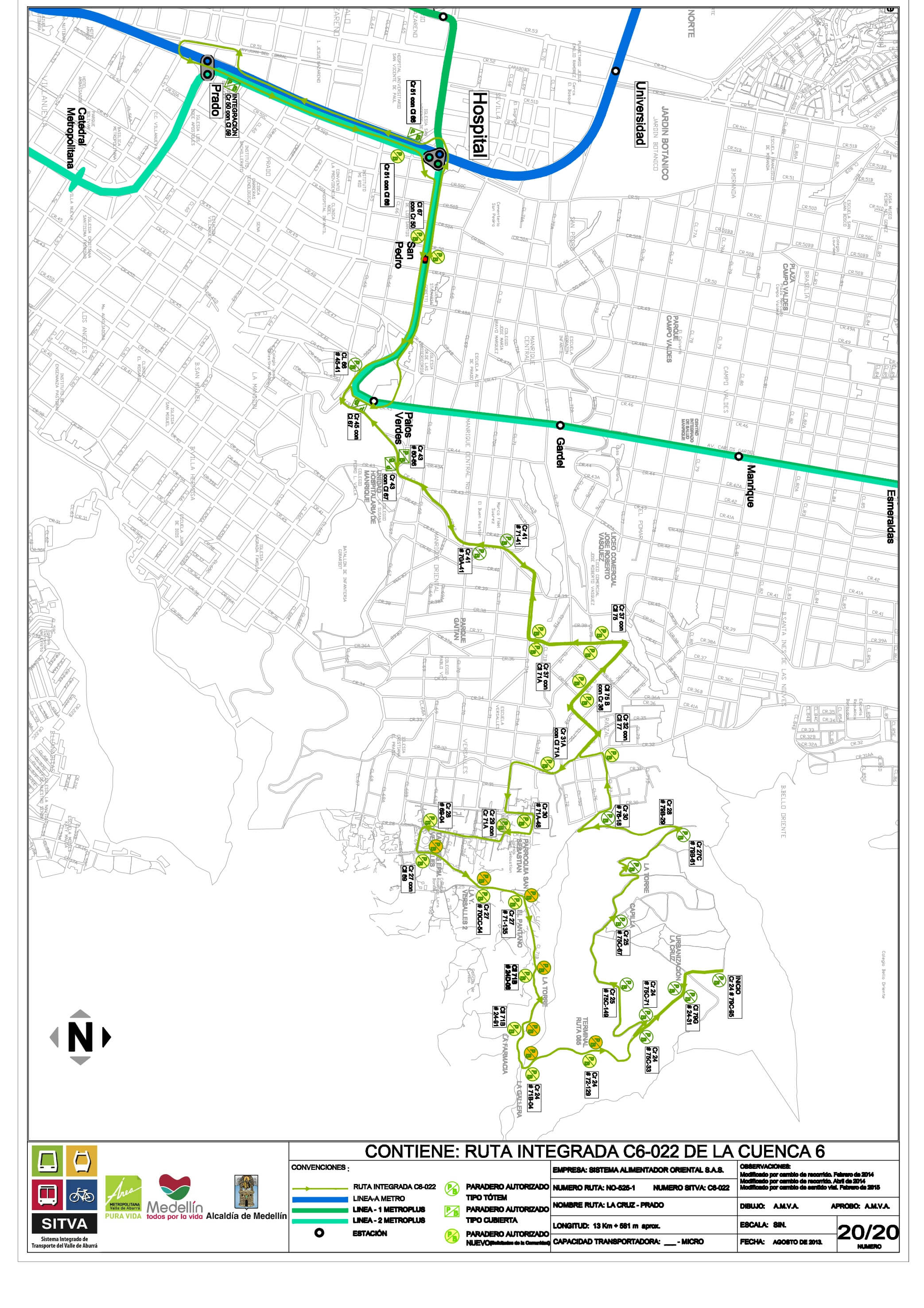
C6-023 Santa Lucía - 8 de marzo - Est. Alejandro Echavarría
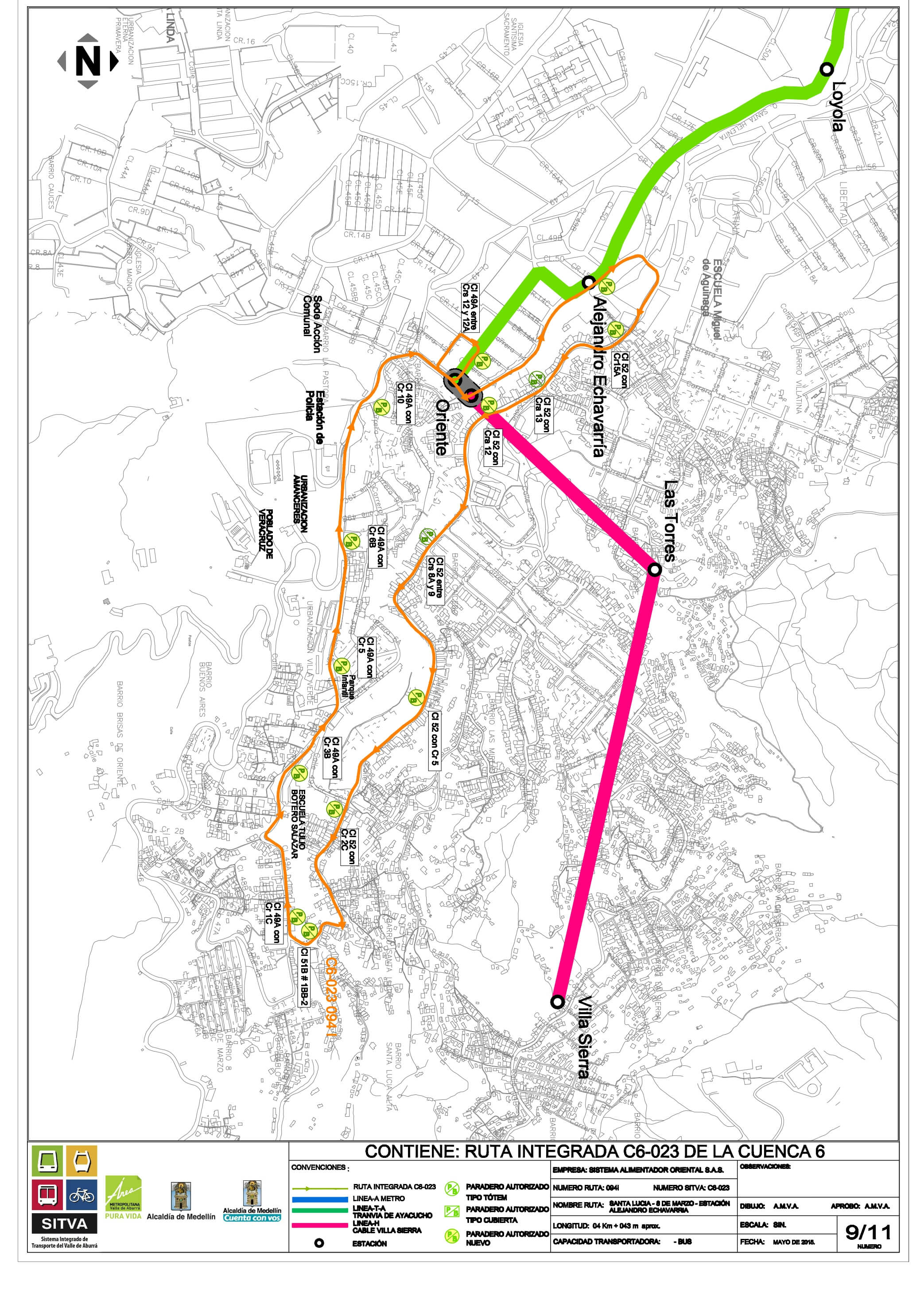
C6-024 8 de marzo - Santa Lucía - Est. Alejandro Echavarría
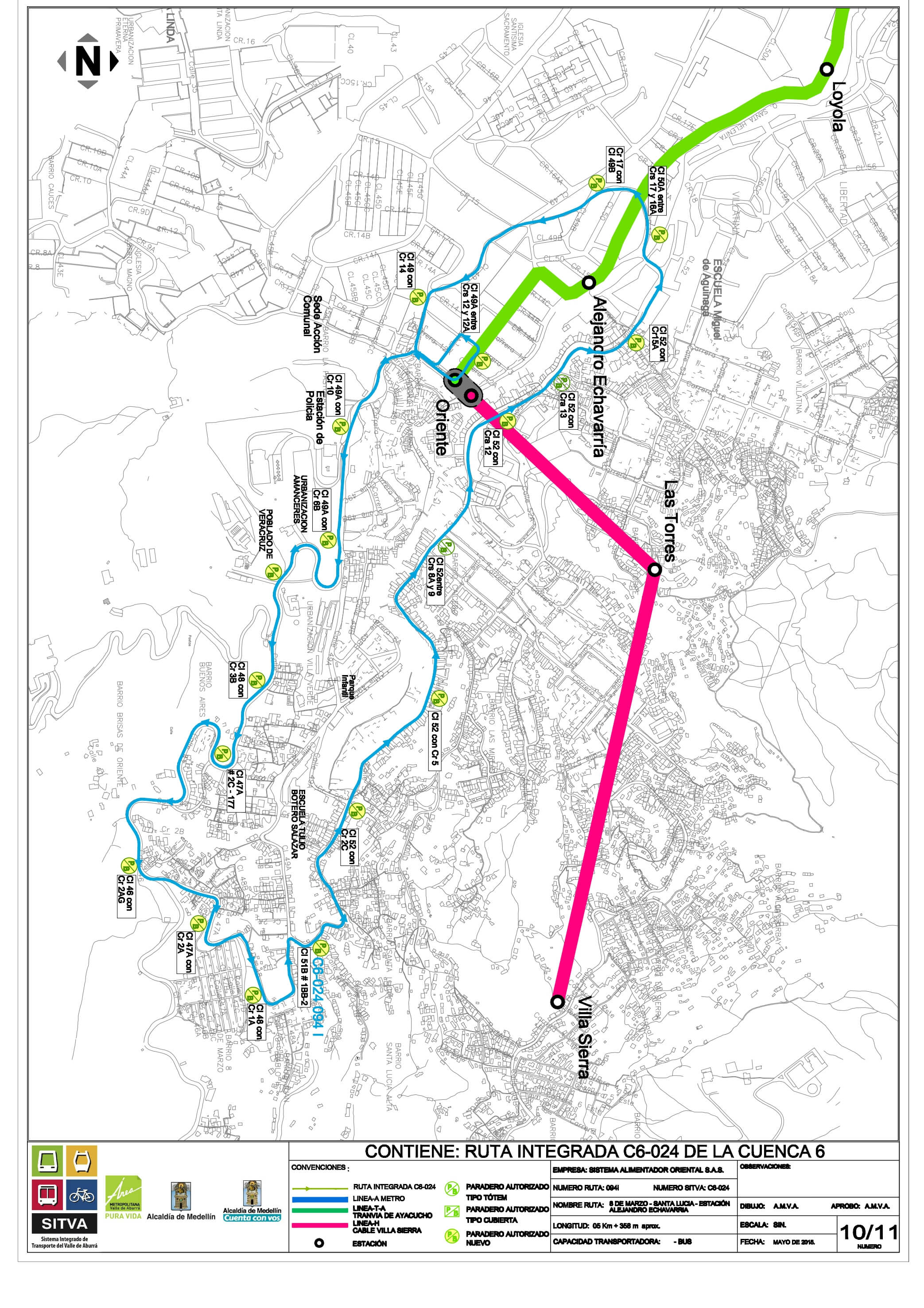
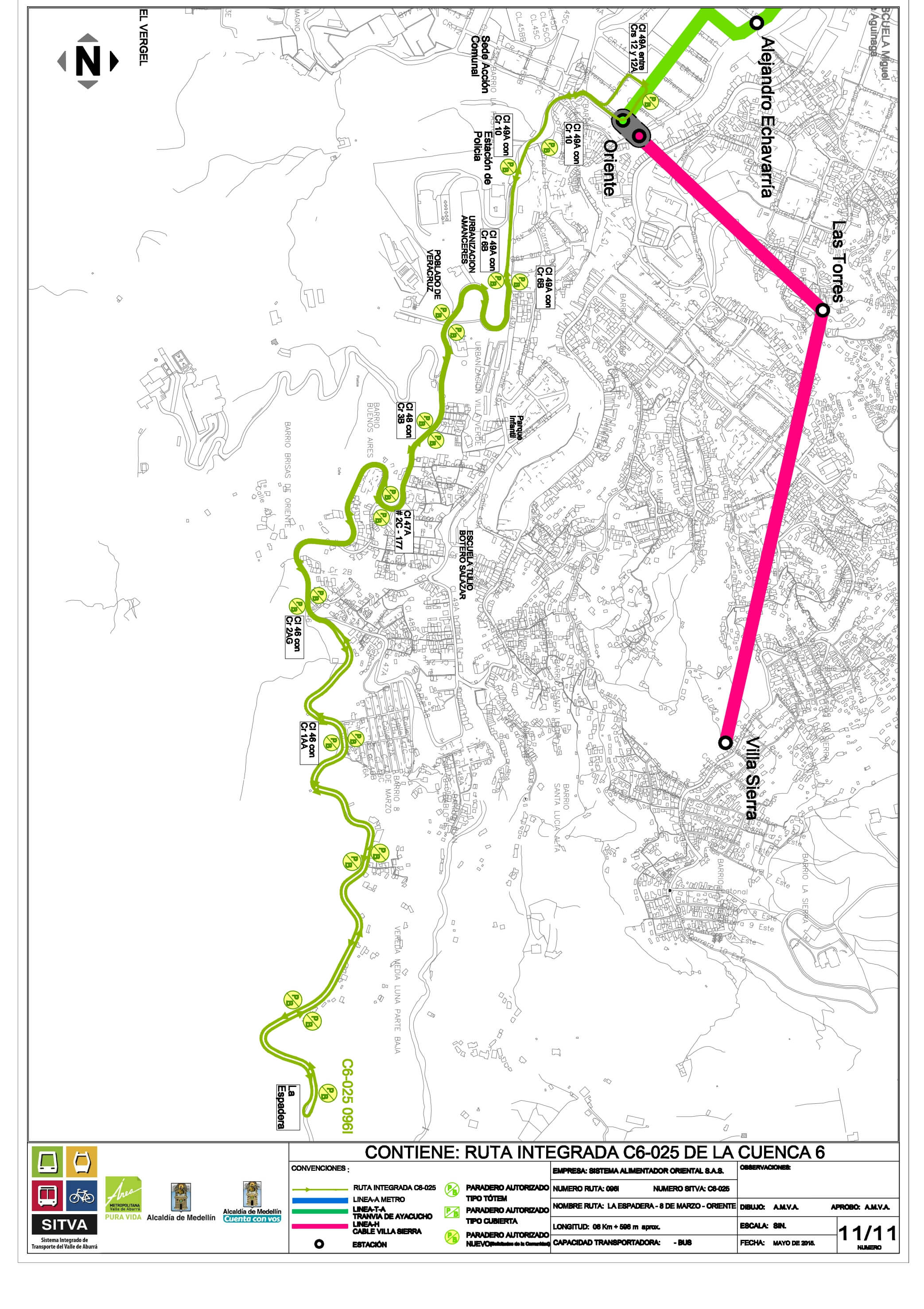
C6-025: La Espadera – 8 de marzo – Est. Oriente
Cuenca 3, route maps
C3-001 Santa Gema - Aguacatala
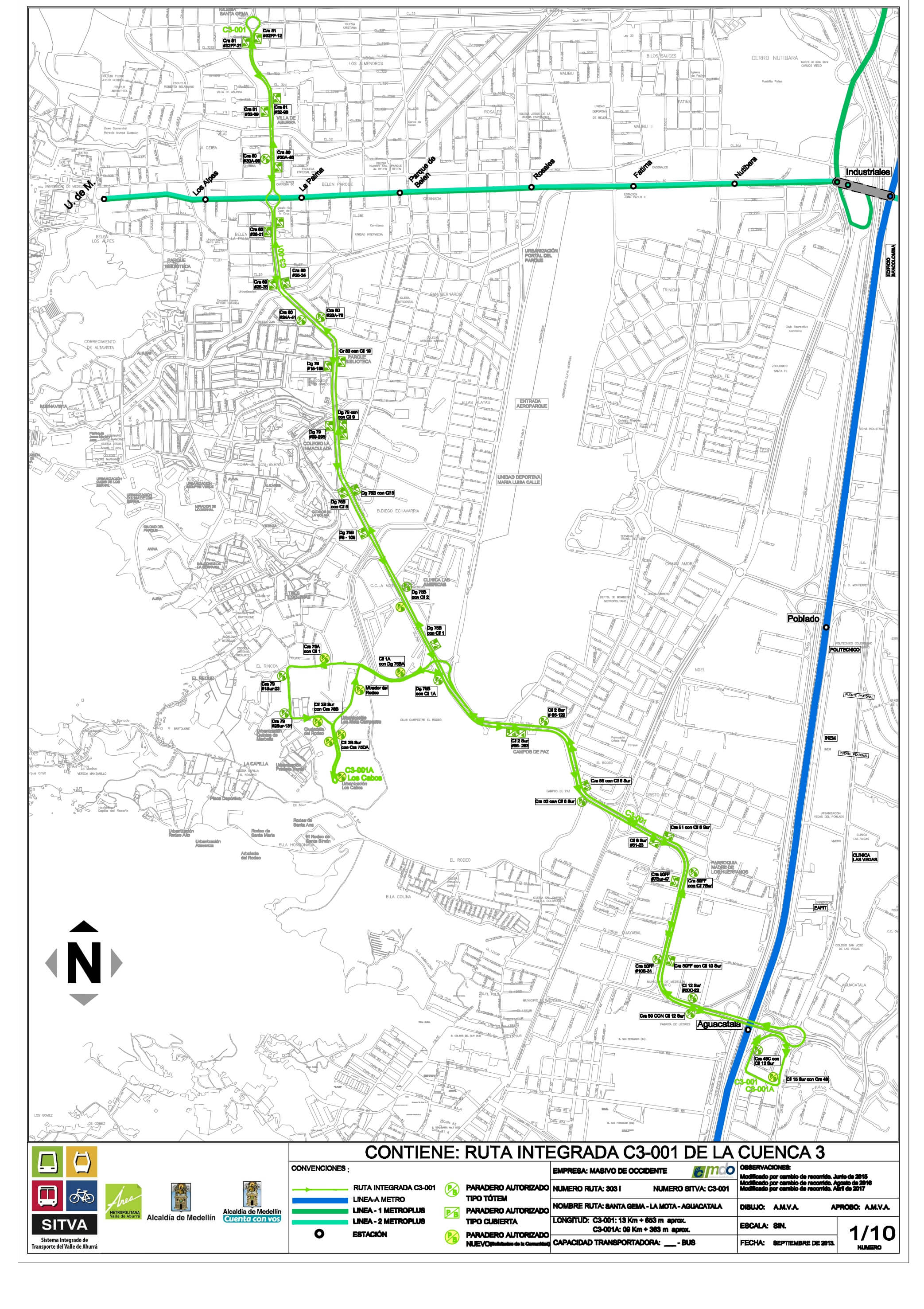
C3-001-A Los Cabos - Aguacatala

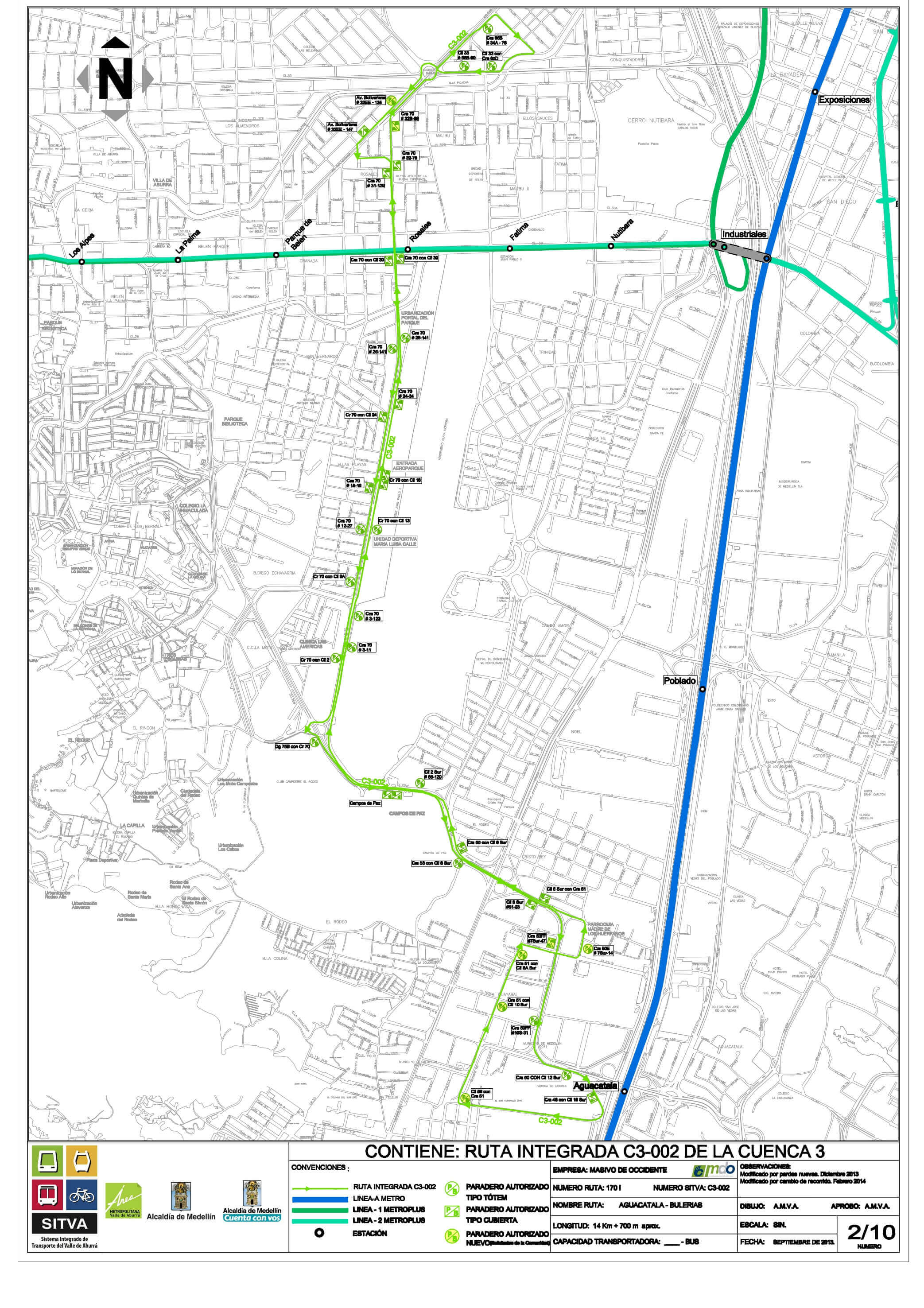
C3-002 Aguacatala - Bulerías
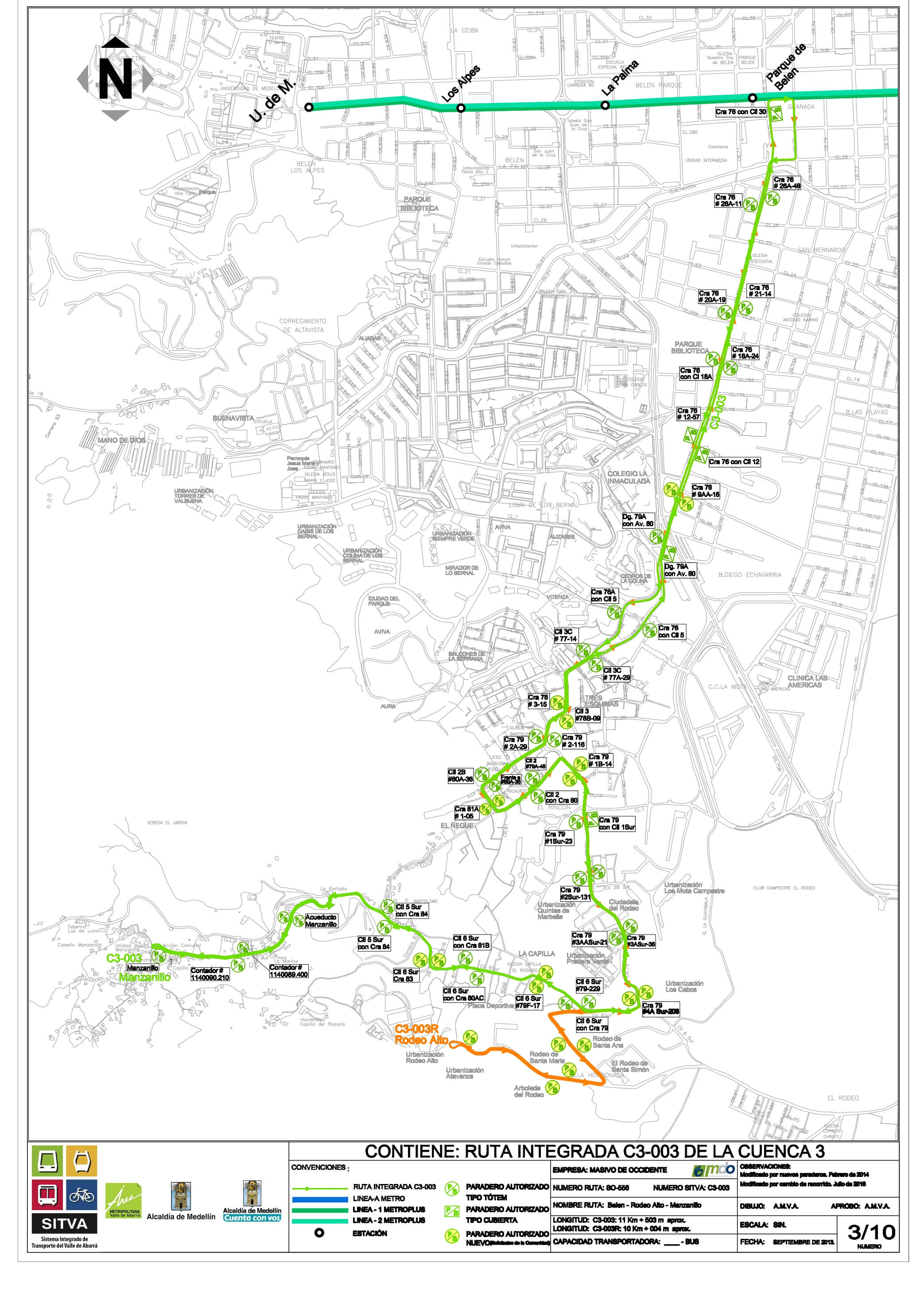
C3-003M Belén - Manzanillo
Description tab content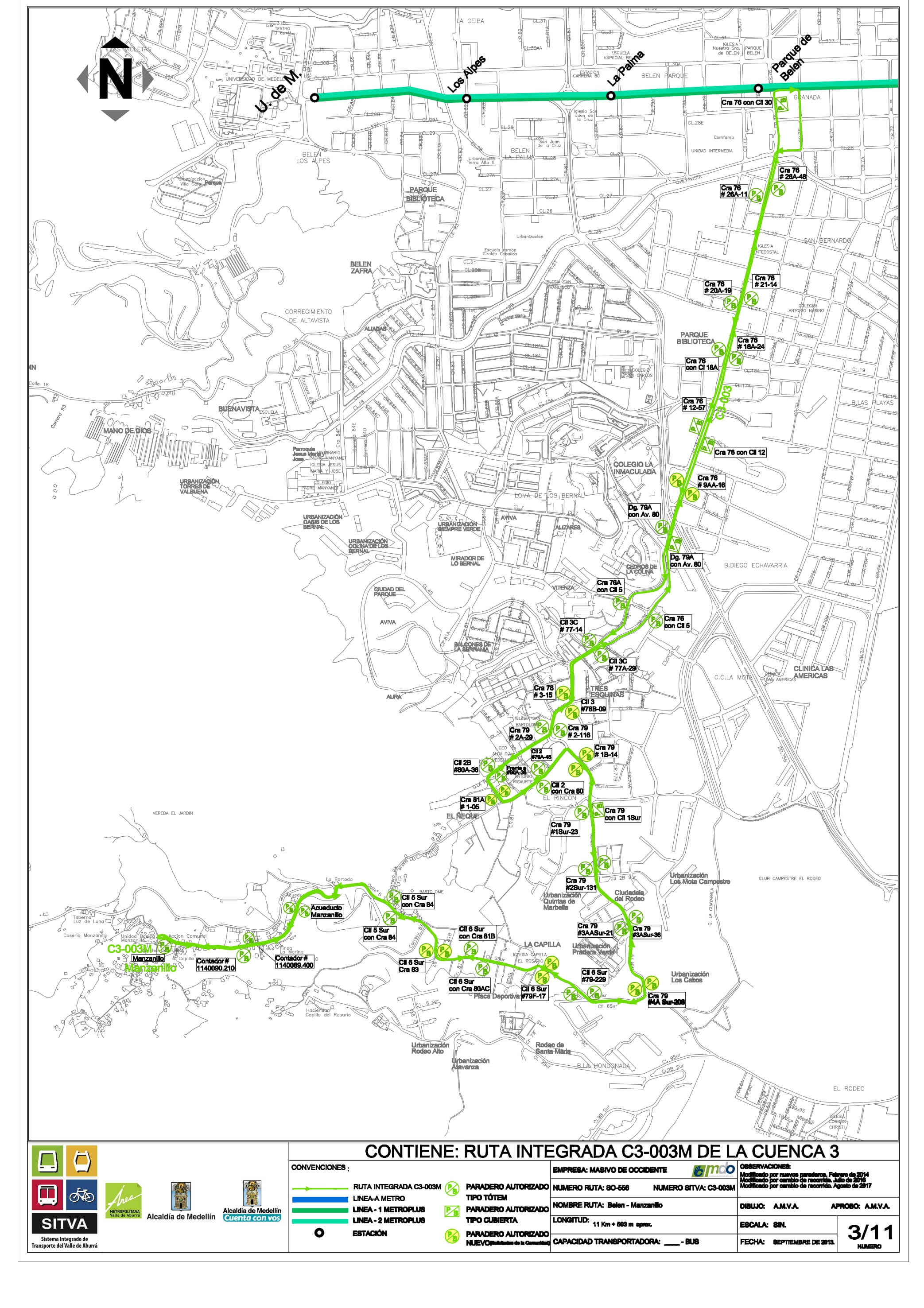
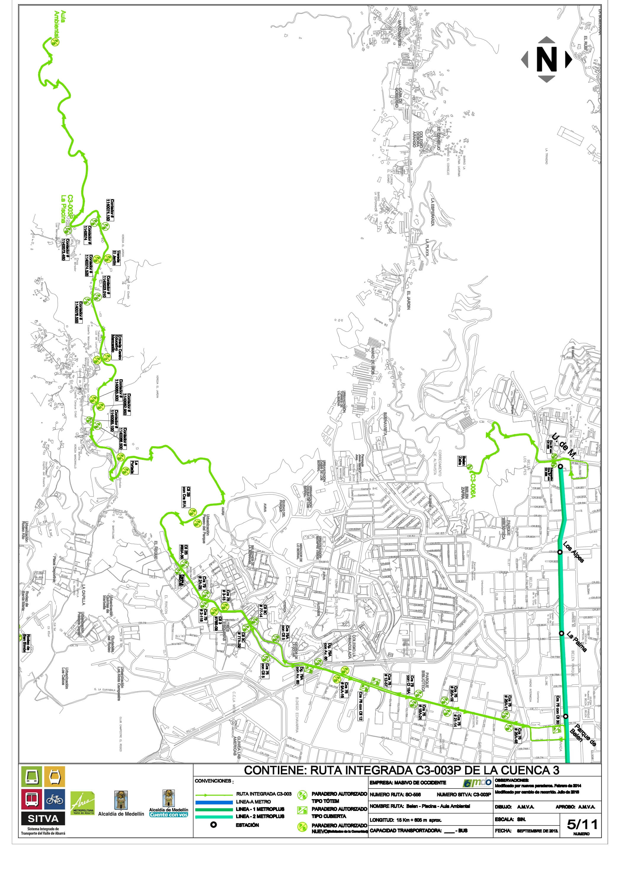
C3-003P Belén - La Piscina
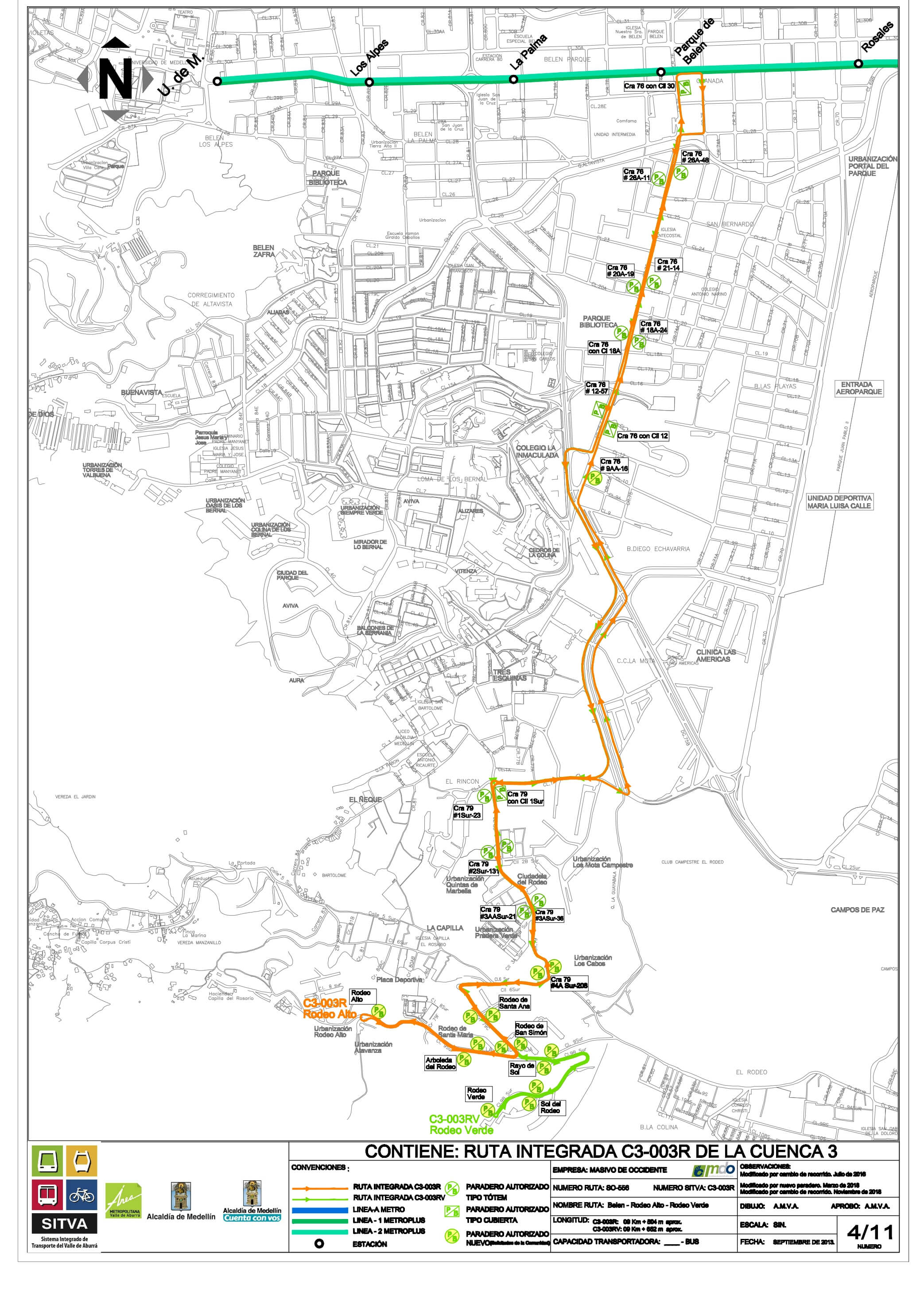
C3-003R Belén - Rodeo Alto - Rodeo Verde
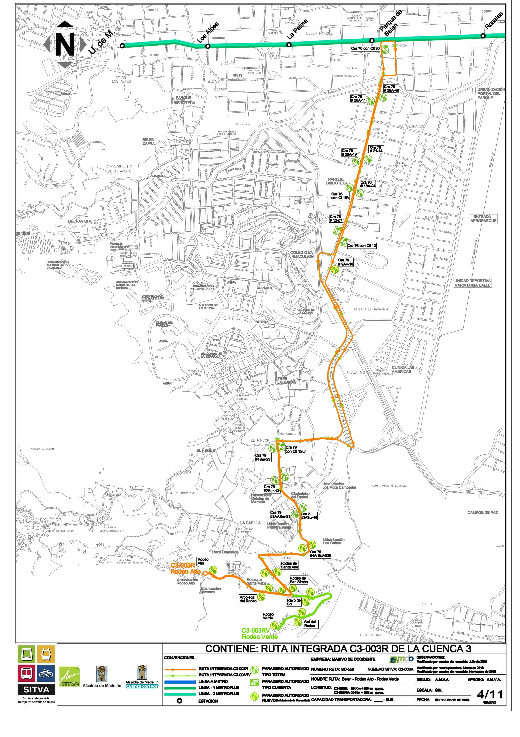
C3-003RA Belén - Rodeo Alto - Manzanillo
C3-003RLC Belén - Los Cabos
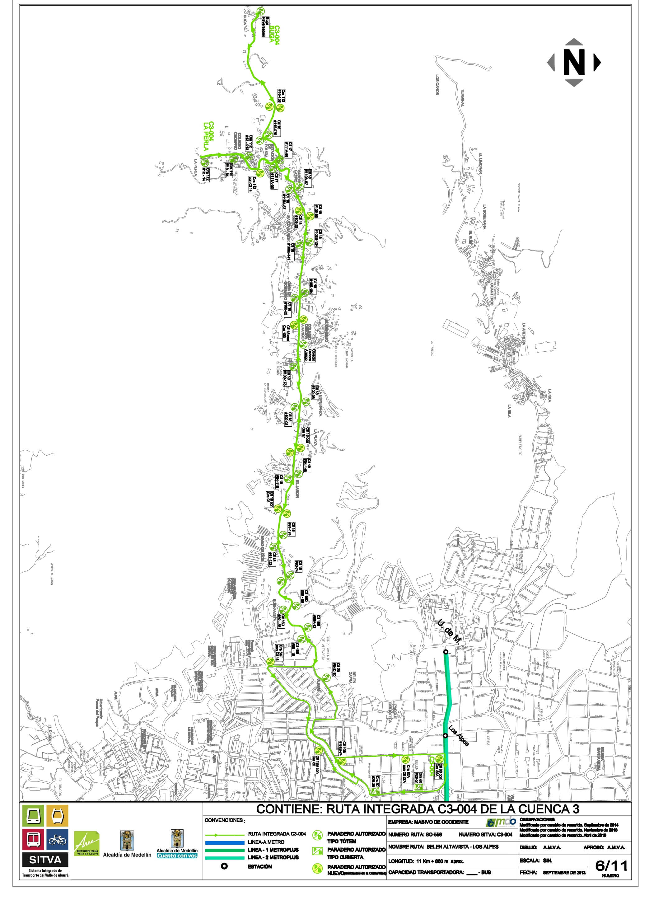
C3-C3-004B Altavista - Buga
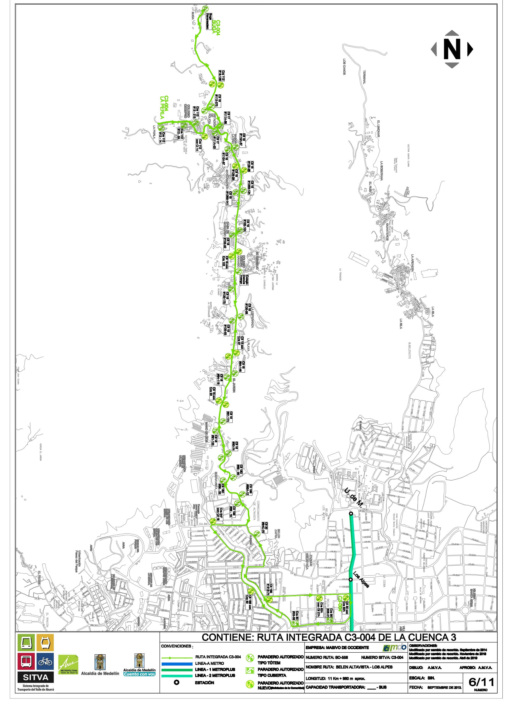
C3-004P Altavista - La Perla
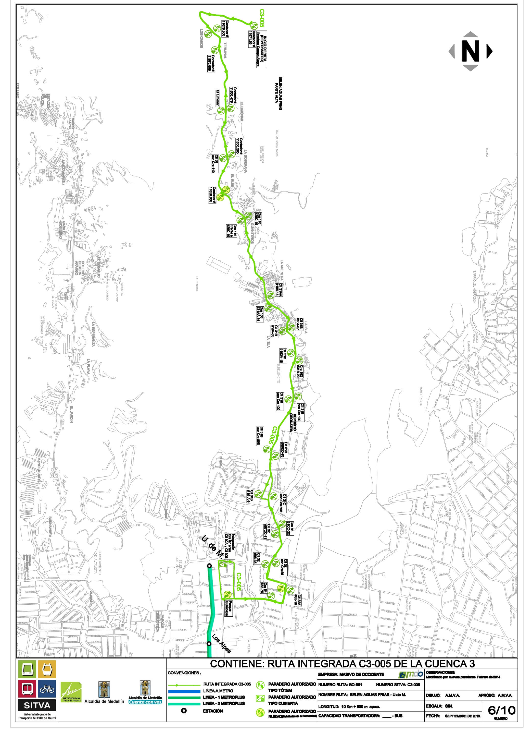
C3-005 Belén Aguas Frías - Universidad de Medellín
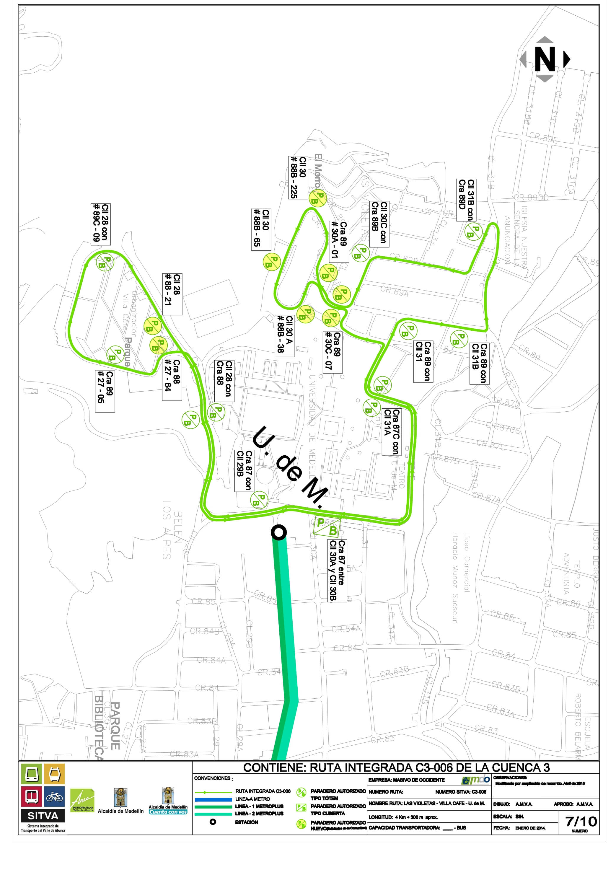
C3-006 Las Violetas - Universidad de Medellín - Villa Café
C3-007 La Palma - Loma de los Bernal
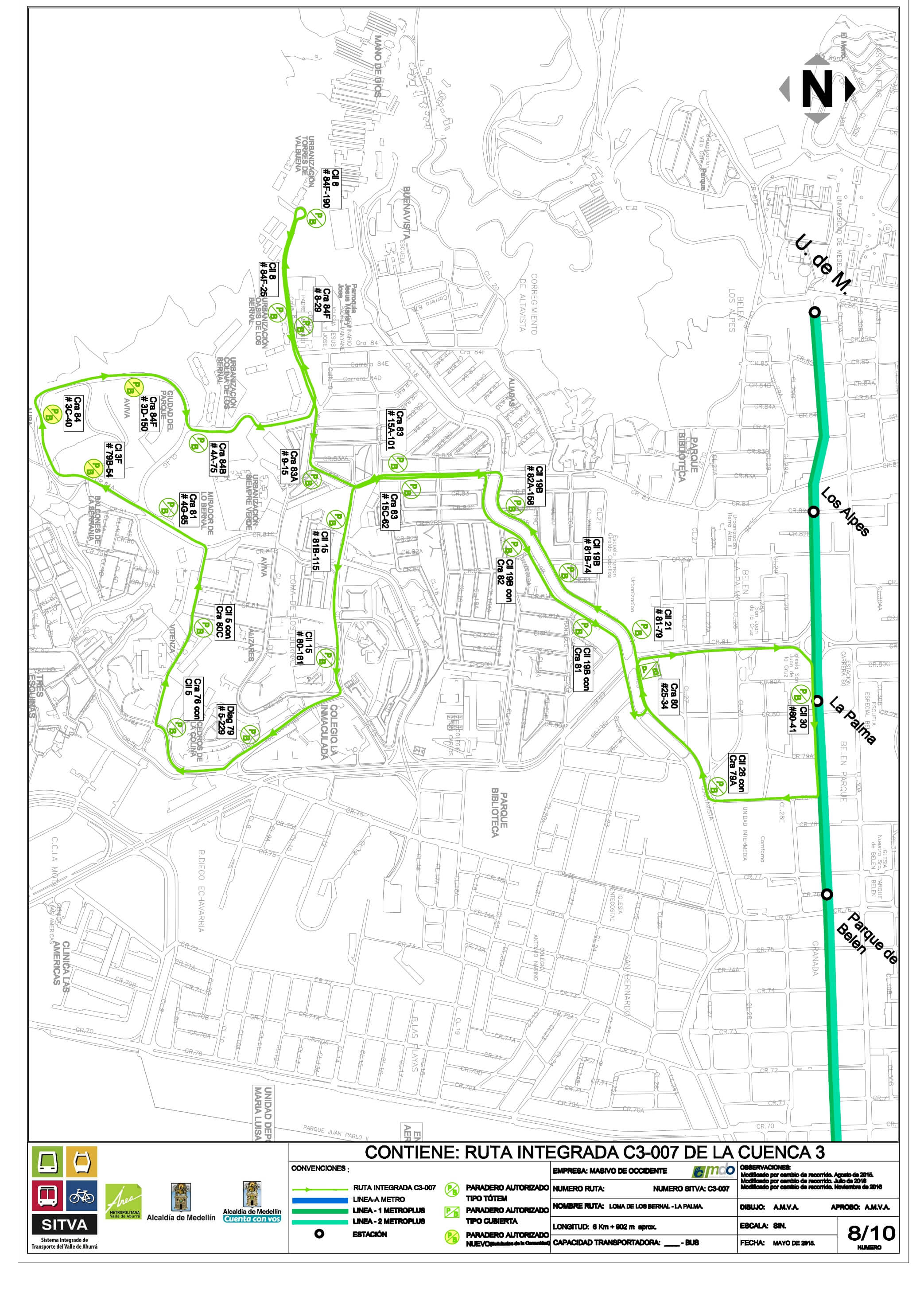
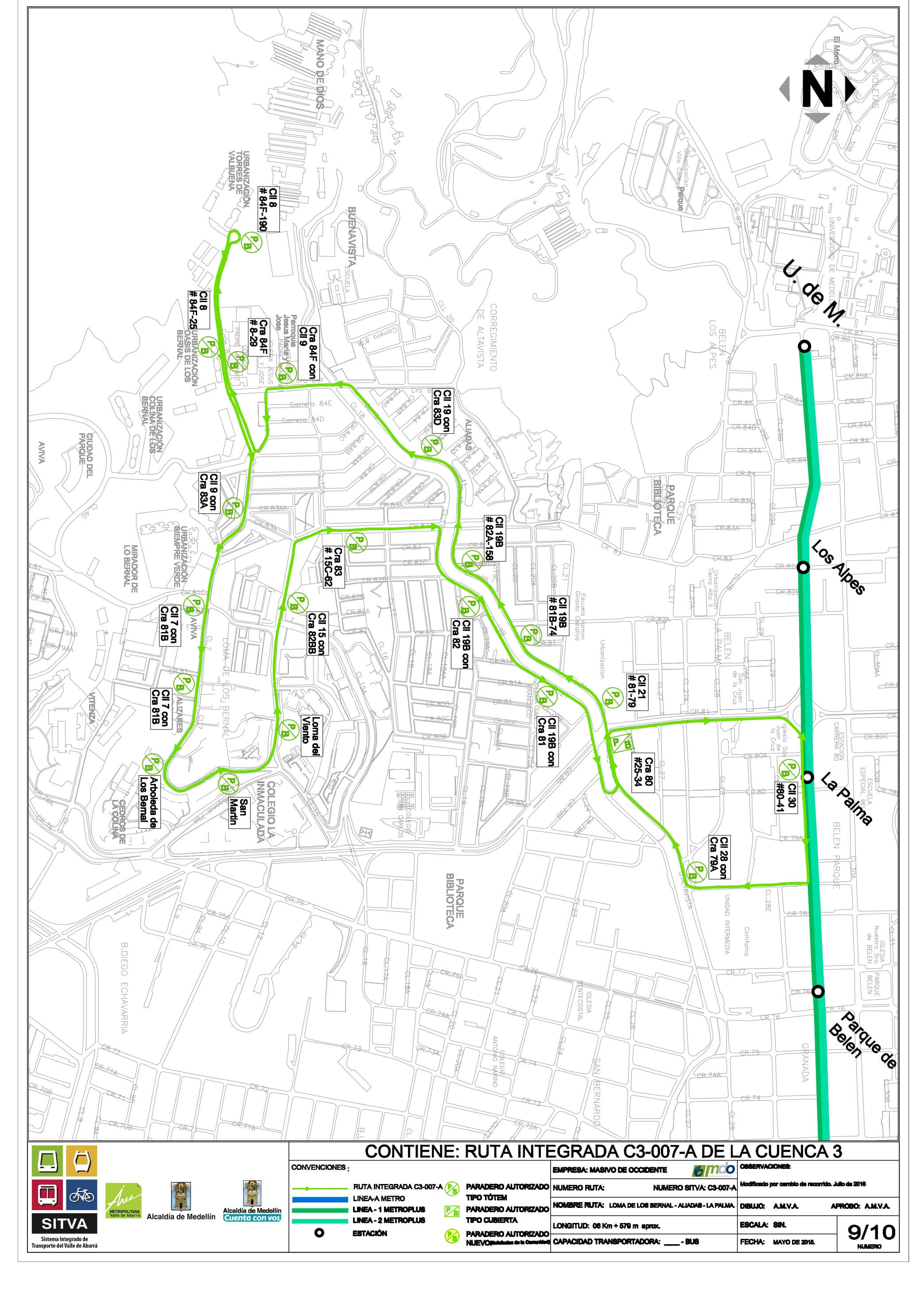
C3-007A Loma de los Bernal - Aliadas - La Palma
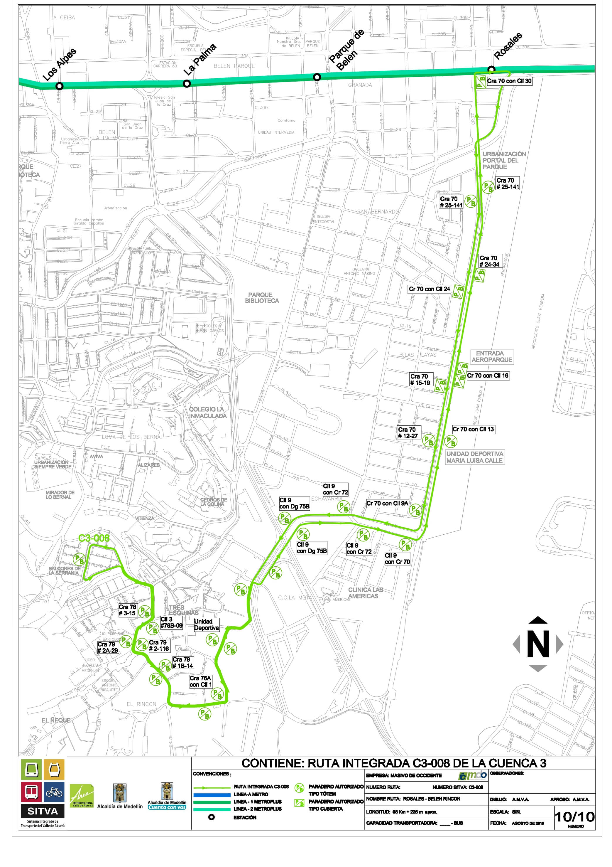
C3-008 Rosales - La Serranía
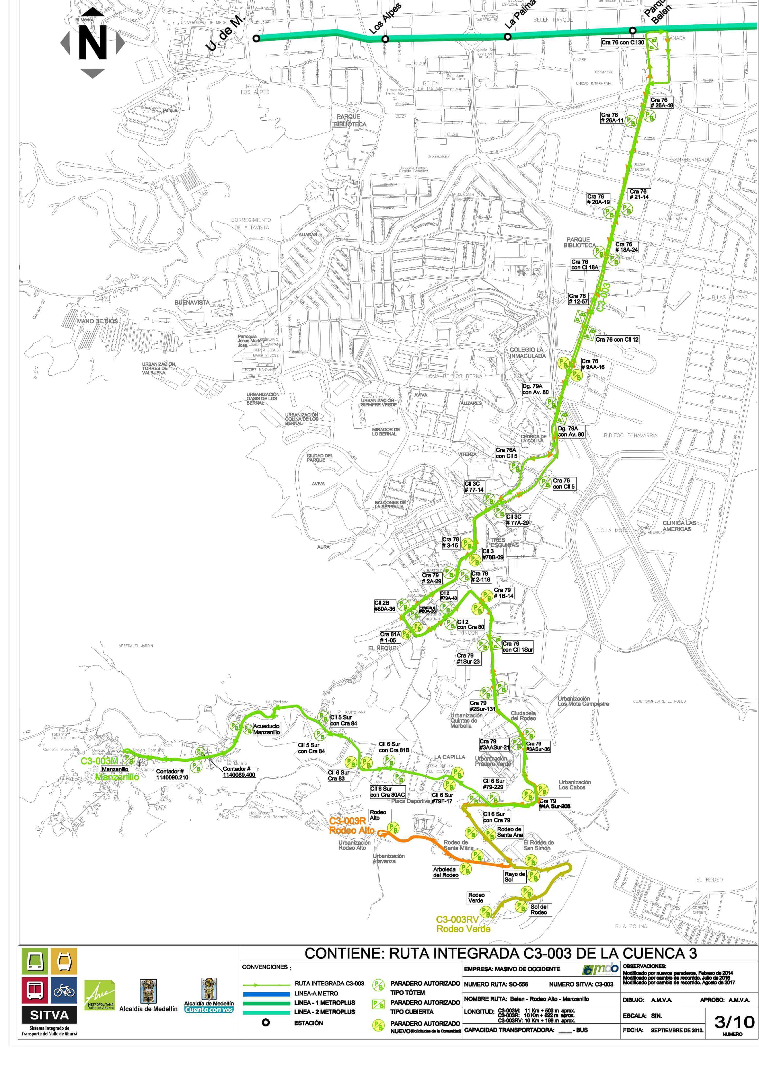
C3-003RV Rodeo Verde
Título
Description tab content
General information about the Integrated Transport System
System type
4 modes
12 lines
System length
85,12 km
Metro length
31,3 km
Aerial cable length
14,62 km
Mainroad BRT length
12,5 km
Pre trunk standard bus length
22,5 km
Tram length
22,5 km
Total stations
45
Stops
31
Bus stop
32
Total train cars
240
Cable cars
499
Articulated buses
31
Standard buses
111
Tram vehicles
12
Number of sheave trains
124
Capacity
86.078

